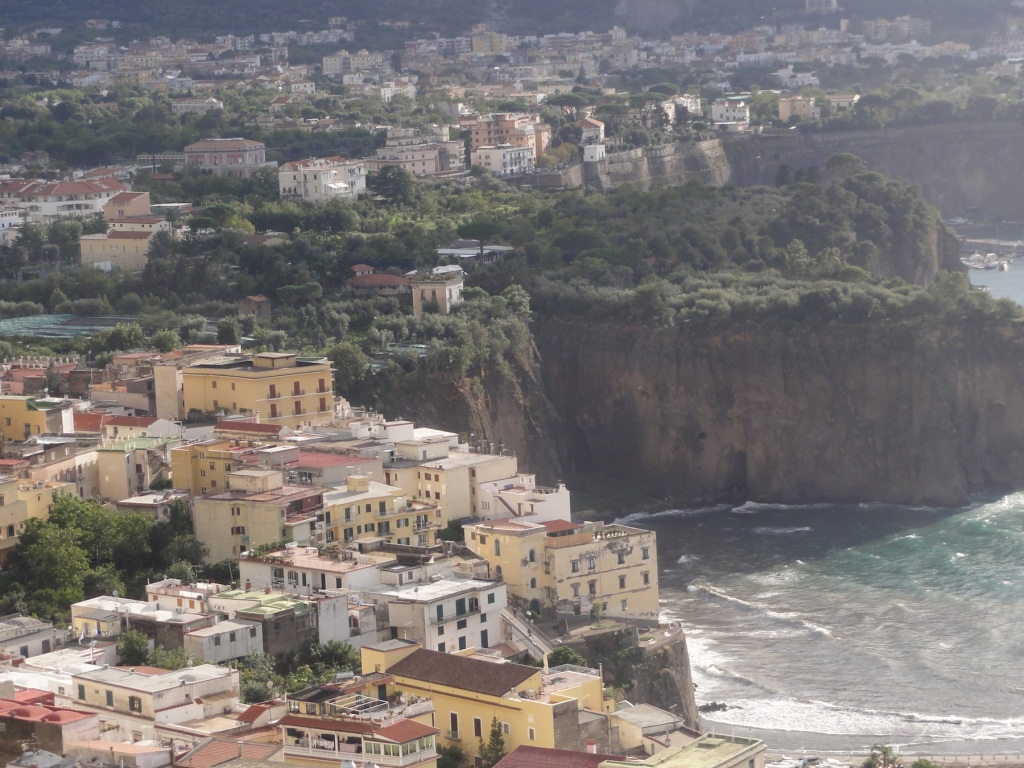
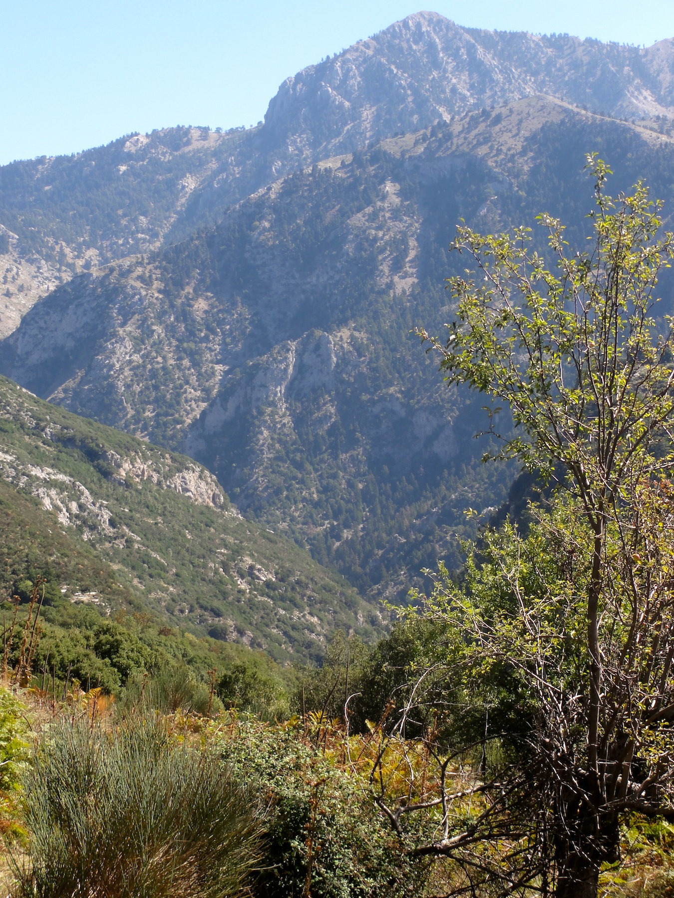
The weather on the day of our return to Switzerland was beautiful again, clear sky, warm air, sunshine. Soon after leaving the traffic jam of Milano, the silhouettes of Alps have become visible. Along the lake of Como and the Valley of Veltline (with its vast grape yards and excellent wine!) we reached Tirano, the gate way to the Valley of Puschlav, the Italian speaking region of the Swiss Canton of Grisons. Quickly we gained altitude. The meadows were luscious green, the larches golden and the top of the mountains white – what a welcome back home. Over the pass of Bernina in blazing white snow we reached on the other side the Valley of Engadin with its picturesque villages in the typical Engadin style. We decided to make a last stop in Scuol in the Eastern part of the Engadin (border to Italy and Austria) with a visit to Gabi’s brother Daniel, who lives with his family in this mountain village for the last 40 years. On Friday, our last day of our trip back home, we hiked through the mountain valley around Scuol. Above us the blue sky and the snow mountains and we in the midst of green pastures and yellow coloured forests. We hiking together with many other pensioners through traditional villages with its typical graffiti decorated houses. And we agreed to the many people we met on our long journey back home about their appreciation of Switzerland as a place of natural beauty and economic, political and social stability.
On Saturday, 24 October, we left Scuol for ‘our’ village Uetikon-am-See and after 3 months and 12 days we reached our home. The family of our eldest daughter living in the neighbouring village and dear neighbours warmly welcomed us. The fridge was stuffed with the most essential food to ‘survive’ on Sunday. The slogan on my T-shirt my staff in Tbilisi has coined, printed on a T-shirt and gifted to me: ‘goodbye tension, hallo pension’ will continue hopefully in our life after the long trip, here in Switzerland.
Bei schönstem Wetter sind wir am 22. Oktober bei Tirano (Veltlin) in die Schweiz eingereist und haben auf der Fahrt über den Bernina Pass die Bilder der verfärbten Lärchen, in Kombination mit den verschneiten Berggipfeln und dem tiefblauen Himmel in uns aufgesogen. Die Schweiz ist ein wunderbares Land.
In Scuol wohnt mein Bruder Dani und seine Familie. Bei ihnen haben wir Station gemacht und auf einer Wanderung über Scanf auf den Motta Naluns und wieder zurück einen tüchtigen Muskelkater eingefangen und mit ihnen das erste Fondue gegessen.
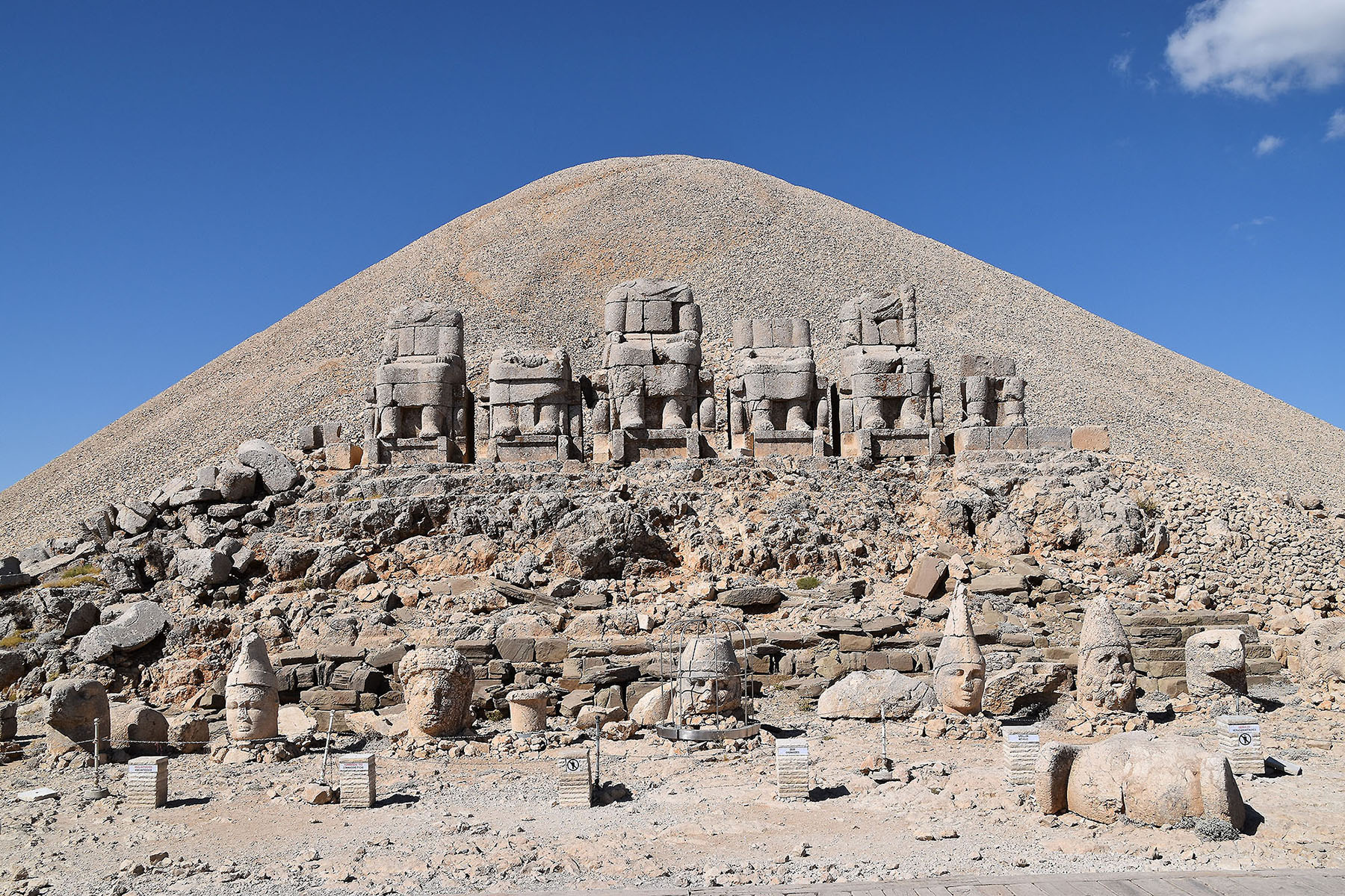
Milano – visit to my godmother and cousin, October 18 -20, 2015
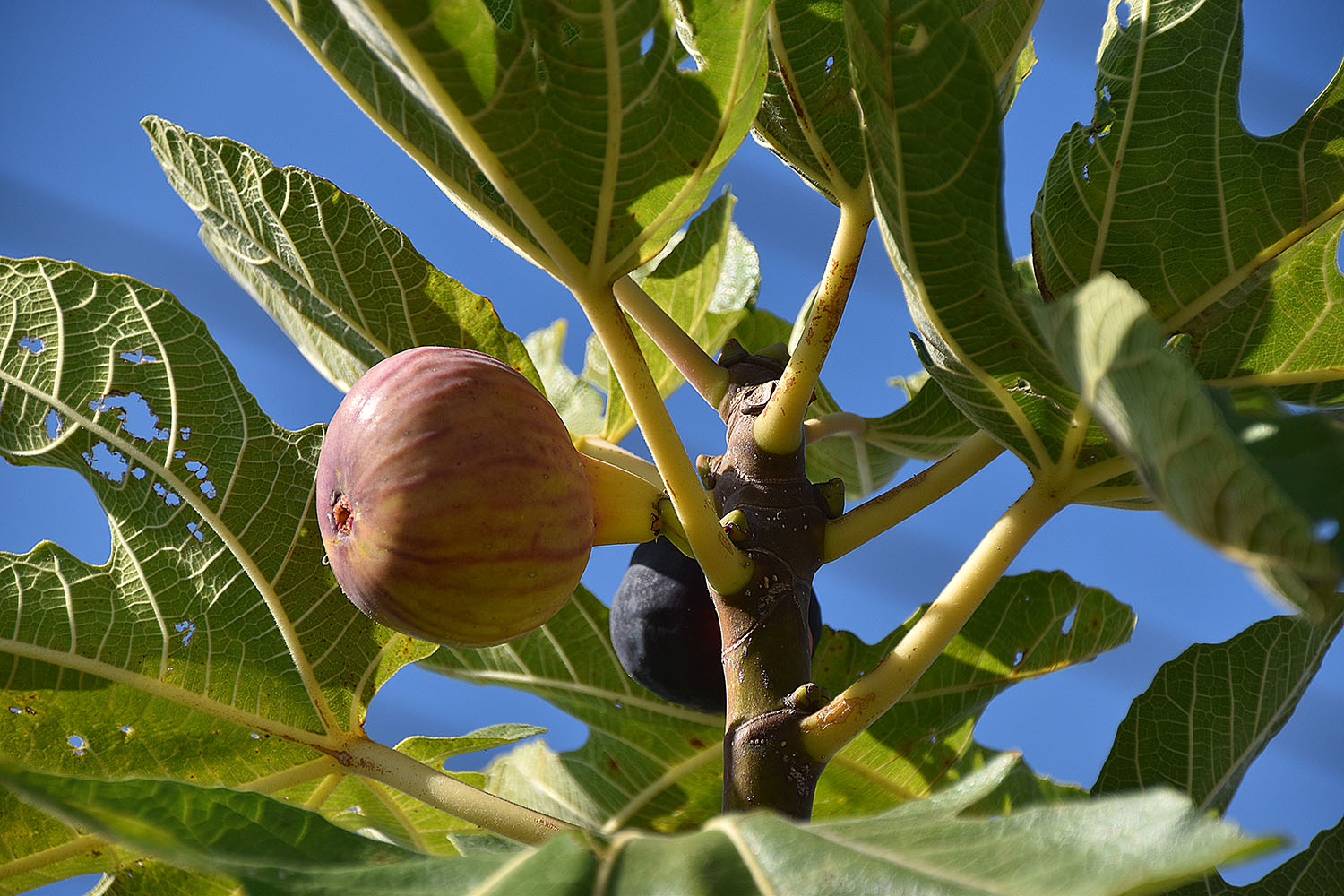
Winery in the Barolo Region of the Piedmont
On Wednesday morning, October 18, we headed from Mondovi to Milano. The rolling hills of the Piedmont were still covered with mist when we left. Towards noon the fog has given way to sunshine. We drove on country roads through the famous wine region of Barolo. The harvest was over. The leaves in the extended wine yards were shining in red and yellow pastel colours. The old wineries resembled feudal castles displaying the richness of the region.
Urban gardening
In the late afternoon we reached Milano and got caught by the heavy traffic. Thanks to the GPS we quite efficiently found our hotel, a lodge at the Viale Famagosta, close to the apartment of my godmother Elvira and her daughter and cousin Gabriela with family. A surprise phone call ensured that they are at home in the evening. I haven’t seen Elvira and the cousin for 6 years at least. We spent two very nice evenings with them. We had so much to talk. Elvira is 89 years old. Walking has become difficult but the brain and memory works as she would be 25 years young. Her stories about her employment in Istanbul shortly after the 2nd world war in an import and export company and thereafter the work in a grocery shop in Naples where she caught typhus was new to me as well as the story was new to me how my grandfather interfered through his political connections in the city council of Zürich to ensure her a decent room in the hospital of Naples was new to me. We spent the evenings in a restaurant. The pizza was excellent, the spaghetti al dente and delicious, the wine superb – best Italian cuisine managed by Egyptian immigrants.
Modern steel and glass architectureA huge crowd of visitors at the Cathedral of MilanoStylites on the Cathedral of MilanoBest pizzeria managed by Egyptian immigrants
On Thursday we first wanted to visit the World Expo. However we finally decided against it: there were too any last minute visitors causing waiting times up to eight hours for entering country pavilions. Therefore we went for a long city walk in the centre of Milano. We were stunned by the modern architecture of steel and glass buildings. Time and again, the historic part of the central area with the Victor Emanuel Passage, the Cathedral, the Scala and other famous buildings and exhibitions are worth a visit. We had to ‘plough’ through huge crowds of visitors. The sad part is that we met the many refugees again trying to sell odd things hardly anyone needs to finance their trip northwards. Women with head scarfs washed the wind screeds of cars hoping to get a few cents. What a contrast to the elegant boutiques. Italian fashion is second to none – the prices in the shops at Victor Emanuel Passage too! After a good number of the best coffees of the world – the Italian Expressos – we went back to our relatives and the Egyptian pizza restaurant at the Viale Famagosta. The day after we left for Switzerland!
Mondovi 18.-20. Oktober
Von Follonica (Toscana) sind wir nordwärts Richtung Piemont gefahren wo uns in Mondovi unsere amerikanischen Freunde aus Tbilisi erwarten. Jim und Leslie wohnen seit 3 Jahren im 2o tausend Seelen Städtchen, haben vor 2 Jahren ein altes Haus gekauft und sind seit einem Jahr mit dem Umbau beschäftigt.
Lunch
In den Gassen von Mondovi
Ein Spruch vom Hausbesitzer
Mondovi
Leslie und Jim`s Haus
Castagnata
Mondovi
Wir treffen uns auf der Piazza, wo gerade eine Castagnata im Gange ist. Kastanien werden auf offenem Feuer auf der Piazza in grossen Pfannen geröstet; mit einem Glas Rotwein ist dies ein leckerer Apéro. Wir haben mit den beiden eine tolle Zeit verbracht bei einem Ausflug am nächsten Tag und zwei Abenden in gemütlicher Atmosphäre.
Überfahrt nach Italien
Seit dem letzten Blogeintrag sind 14 Tage vergangen. Vor gut einer Woche sind wir in Italien eingereist – von Patras mit der Fähre nach Bari. Im Schnellzugstempo sind wir nach Norden weitergereist (die Idee, Sizilien zu entdecken, haben wir fallen gelassen, des Wetters und der Reisemüdigkeit wegen).
Unsere Übernachtungsstationen in Griechenland nach Sparta: Sparta- Nafplio- Loutraki(bei Korinth)-Patras.
Unsere Übernachtungsstationen in Italien: (Patras)-Pompeii-Sorrent-Terni-Perugia-Follonica-Arenzano (westlich von Genua).
Überfahrt nach Bari:
Bye-bye Griechenland
Kurz vor der Ankunft in Bari
Ankunft in Bari
Der Regen und der graue Eindruck in der Stadt Bari haben mich so sehr belastet, dass wir noch am Ankunftstag in strömendem Regen nach Pompeii weitergefahren sind.
Auf der Fahrt nach Pompeii
Die Fahrt nach Pompeii
Das antike Pompeii zu besichtigen war ein Wunsch von Ruedi.
Ich wollte den Vesuv –krater von nahem betrachten. Auf halbem Weg zum Vesuv sind wir dann wieder umgekehrt, weil wir mit einem Touristenstrom im Bus hätten hinauffahren müssen.
Vesuvio
Pompeii haben wir einen Tag lang zu Fuss erkundet (Ruedi wird darüber berichten).
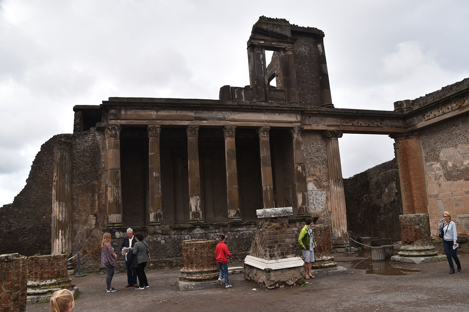
Pompeji, October 11, 2015
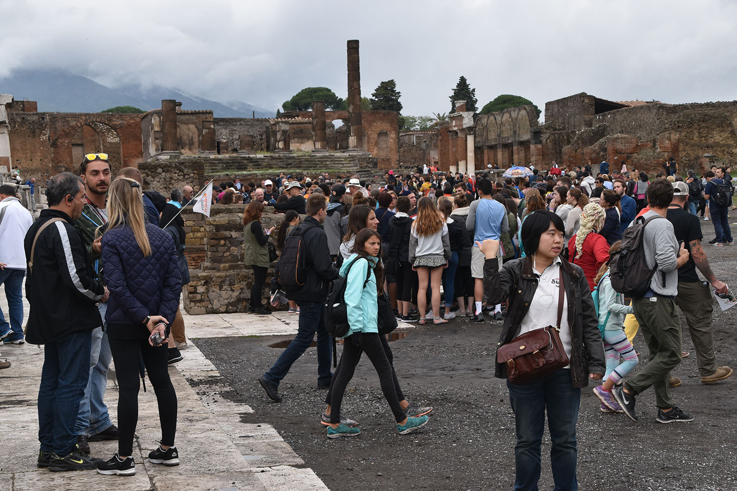
The Roman seaport of Pompeji is Europe’s most visited historic place with around 12 million spectators a year. And indeed the site is worth its 13 Euro entrance fee.
Wall frescoWall frescoFresco in the brothel of Pompeij
Pompeji has been a flourishing town till the nearby volcano Vesuvius has covered it under ashes and lava flows on 24 August 74 AC and brought an immediate end to all life. Pompeji shows us impressively the might of the natural force that lies dormant deeply in this volcano. (Today there are more than 600’000 people living around the Vesuvius.)
Wall freso in a private house. For the Romans freso had the same signifiance as the design and quality of furniture noweadaysMosaic in a Roman public bath
This incredible tragedy for the citizen of Pombeji of those days is an archaeological treasure of today as an entire city has been extinguished and conserved in a few hours under a deep layer of pumice stone (lapilli). The exact course of event has been described by Pliny the Younger in his contemporary legendary description of the catastrophe.
The historic outbreak of the Vesuvius of those days has not been the first one, and not all the 20’000 evacuated inhabitants have returned when the top of Vesuvius exploded and buried around 2’000 people under its ashes.
The town was founded in the 7th CBC, was occupied by the Greek and has become Roman 80 BC. After its destruction it has not been rebuild and disappeared from all maps till to the year 1594, when the Italian architect, Domenico Fontana, found ruins during the construction of canals. The importance of his discovery has, however, not been realised. The real exploration started mid 18th century that was continued with systematic excavations in the 19th century. The research continues till today and new discoveries are still made.
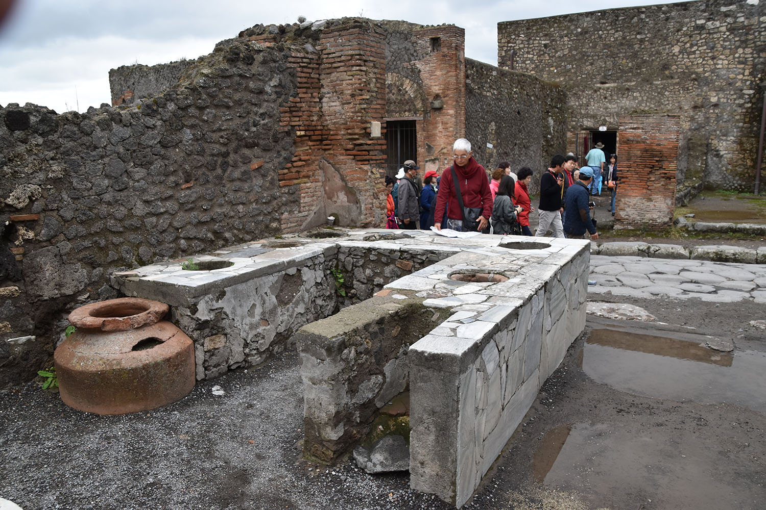
Street in Pompeij with stone blocks to crossFloor mosaic of a dogFloor mosaic in Roman PompeijBasilica (court)
Today one walks through this dead town of around 10 ha newly revived
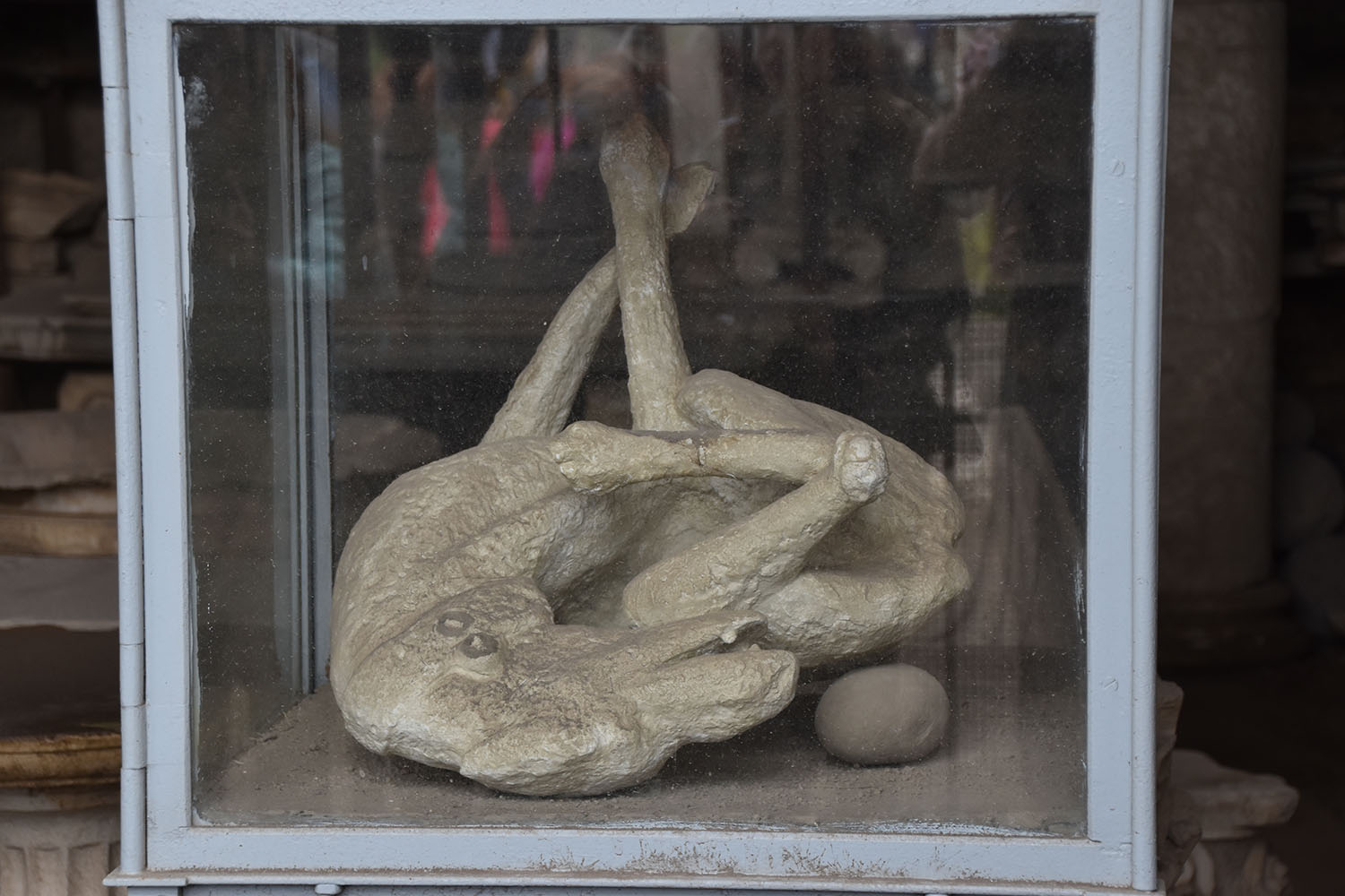
Every year millions of People are visiting PompeijSuffocated dogRoman restaurant kitchen – Roman used to eat lunch outside
with tourists from all over the world. In fact it is rather a constricting feeling to stroll through the ancient sacred temples, theatres, administrative buildings, streets and private houses, to watch restaurants, mills, bathes, brothels, bakeries and restaurants nearly intact. At the same time one admires the quality and beauty of all the structures with their ornaments, paintings, and mosaics. The museum shows the printouts of bodies, adults, children and animals, who suffocated and died under the ashes. It is strange to see how many of the tourists shoot selfies with their mobile phones in front of imprints of these human bodies of which one can make out the immense suffering.
Sorrento:
Einen Abend an der schönsten Küste von Italien, an der Amalfiküste zu verbringen, wollten wir uns nicht entgehen lassen. In Sorrent haben wir eine von booking.com hochbewertete Unterkunft in unserer Preiskategorie gefunden. Wie jeden Abend haben wir das GPS aktiviert, um uns vor das „Guesthous“ zu fahren. Elektronisch hätte alles bestens funktioniert; in Wirklichkeit aber sind die Strassen in den italienischen Kleinstätden, speziell an der steilen Amalfiküste jedoch viel zu eng für unseren Volvo. Das haben wir an diesem Abend beim Herumkurven einsehen müssen. Also haben wir auf den Rat des Hotelbesitzers das Auto im Stätdchen stehen lassen und sind mit einem italienischen Büsschen zu unserem Schlafplatz hochgefahren worden. Den Abend verbrachten wir im Städtchen, noch voll mit Feriengästen. Ein Abholdienst ist organisiert. Der platte Reifen am darauffolgenden Morgen war der Preis für die Nacht auf dem Berg. Ein Metallteil steckte im Pneu eines Hinterrades.
Amalfiküste bei Sorrento
Gasse für die italienischen Autos in Sorrento
Narni /Terni
Umbrien ist voll von kleinen Städten auf grünen Hügeln. Eine davon ist Narni, eine sehenswerte Stadt mit immer noch mittelalterlichem Charakter und Sehenswerten Gemäuern.
Auch das Gästehaus, das wir gewählt haben, war eine Überraschung. Wieder hoch auf dem Hügel über dem eigentlichen Zentrum des Ortes hat eine ältere Dame ihr Landhaus zum „Hotel“ umfunktioniert. Offenbar hat dort die ganze Grossfamilie (drei Kinder und Verwandte) zeitweise gewohnt, wenn sie nicht irgendwo in der Welt unterwegs waren (als Turismusfachleute). Jetzt ist sie allein und mietet ihre Zimmer so aus. Das Landhaus ist überwachsen und kaum sichtbar, umgeben von Gärten und Plantagen. Hier war der Zufahrtsweg knapp befahrbar mit unserem Volvo.
Narni, eine mittelalterliche Stadt:
Ich war überrascht, zu sehen wie viele Italier noch in alten Gemäuern wohnen. Langsam verstehen wir auch, warum in gewissen Lebensbereichen die Italiener sehr konservativ und rückständig scheinen. Die Entwicklung ist in den Mauern stecken geblieben und wird von diesen aufgehalten.
Wir erfahren auf dem Weg des Watsapp dass unsere jüngste Tochter Tamara mit der ganzen Familie Ferien macht in Follonica. Für uns war dies ein Grund, über Perugia und Siena nach Follonica zu fahren.
In Siena haben wir uns auf dem Hauptplatz getroffen; was für eine Freude.
Siro mit Fahne
Mona
Mona und Ruedi
In Follonica haben wir bei Sonnenschein ein paar Stunden am Strand verbracht.
Zum letzten Mal auf unserer Reise durch den Peloponnes haben wir das klare warme Meerwasser beim Schwimmen im Badeort Loutraki am Golf von Korinth genossen.
Loutraki
Letzter Schwumm
Akrokorinthos
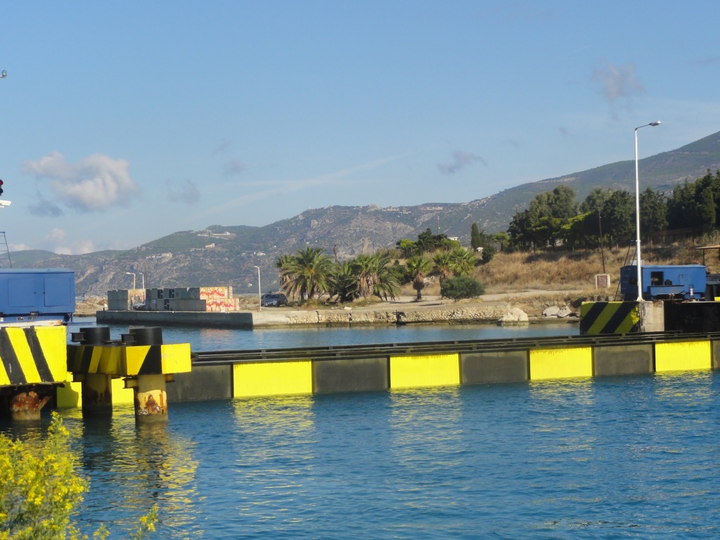
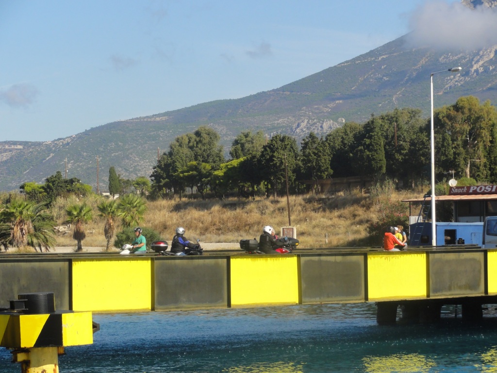
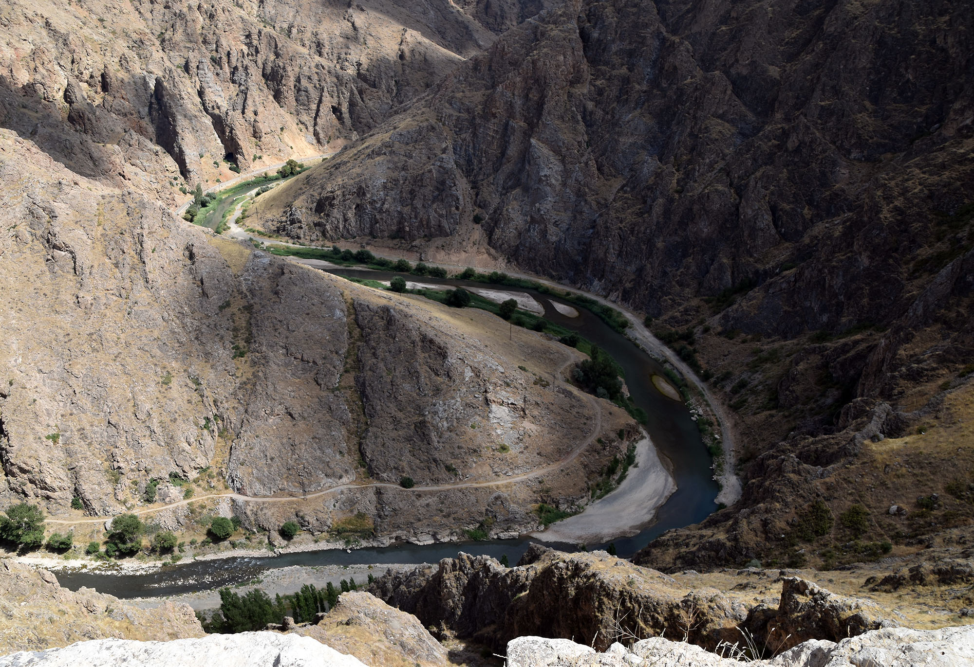
Um nach Loutraki zu gelangen überqueren wir den Kanal von Korinth auf einerm versenkbaren Holzsteg mit Metallkonstruktion.
Kanal 6 km
Die Autobrücke ist versenkt
Ein Touristenboot im Kanal
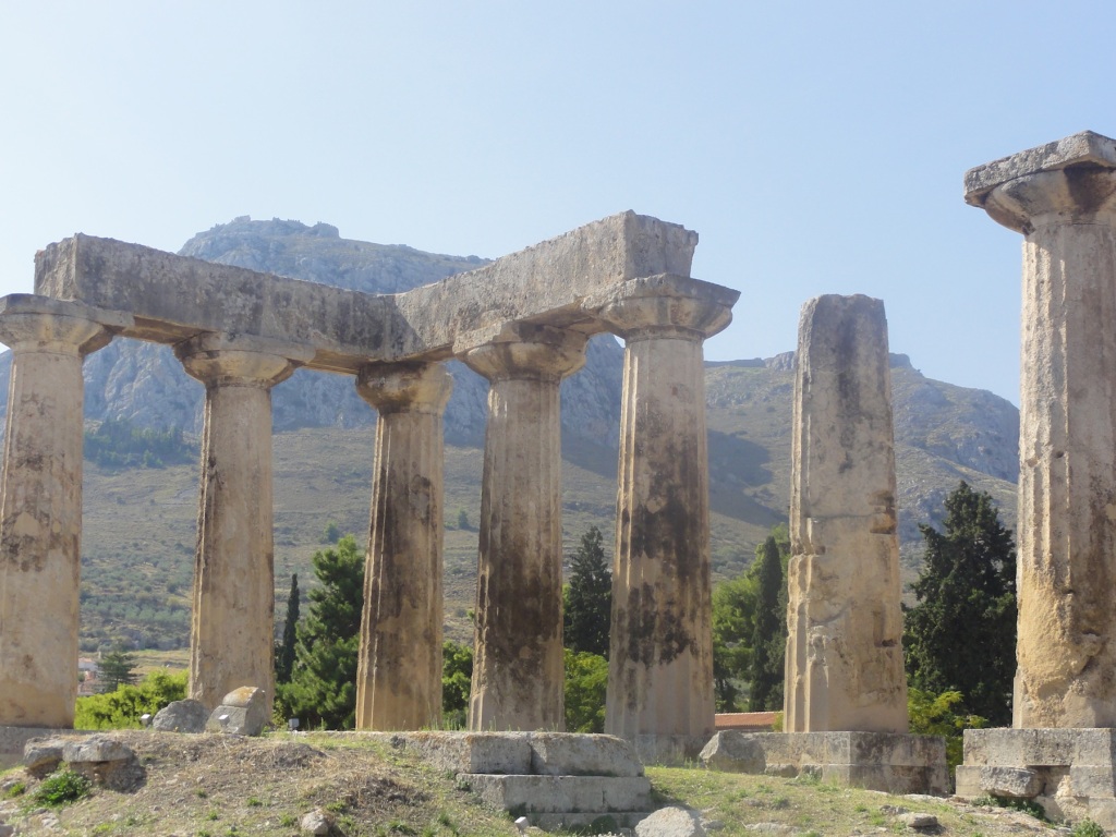
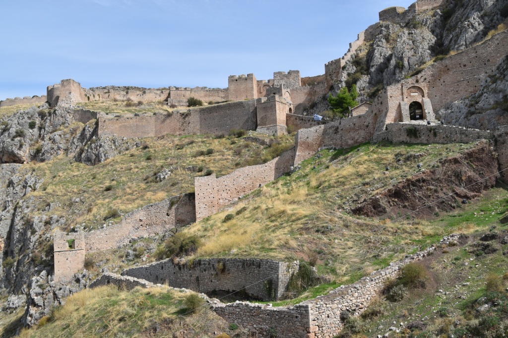
Hier haben wir für 2 Nächte Logie bezogen, um neben dem eindrücklichen, 6 km langen (von Menschenhand ausgehobenen) Kanal den antiken Teil von Korinth und den „Hausberg“ mit der gigantischen ehemals byzantinischen Festung Akrokorinth zu besichtigen..
Einmal oben angekommen ist die Aussicht über den Golf von Korinth bestechend. Die Anlage ist verwildert und riesig.
Altkorinth
Die Landseite
Über Korinth
Korinthe vom Akrokorinthos
Golf von Korinth
Befestigung auf dem Akrokorinth
Auf dem Akrokorinth
Patras:
Mit der „Superfast Fähre“ haben wir die Überfahrt gebucht, eine Kabine für uns für die Fahrt von 18:00 bis um 10:30 am nächsten Morgen.
Patras ist eine pulsierende Hafen- und Studentenstadt mit vielen Restaurants und Läden und natürlch auch einer alten Festung aus venezanischer Zeit.
Im Zentrum von Patras
Roma bereit zur Arbeit am Abend
Hamolstellung
Die Fähren stehen bereit
Hoch über Patras
Gasse in Patras
From Sparti to Sparta, Nafplio, Tiryns and Mycenae – October 4 – 6, 2015
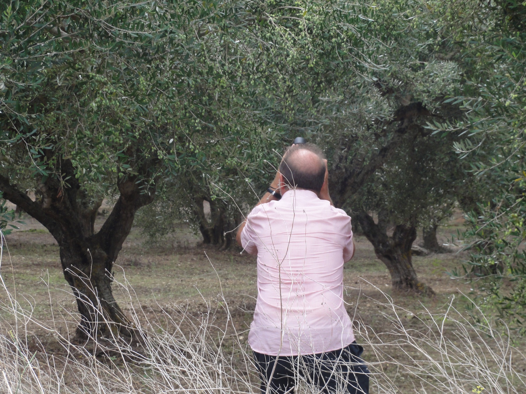
Sparti in the midst of olive groves
From heights of the castle and city of Mystras we could see far down in the plain with the vast olive orchards the modern city of Sparti where we stayed overnight from Saturday to Sunday (Oct 3-4).
When we arrived, the town was overcrowded with Greek cyclists, who raced from Athens to Sparti, altogether 246 km. The race goes back to Pheidippides, the Athenian messenger sent 490 BC to Sparta to seek help against the Persians in the battle of Marathon. According to the Greek Historian Herodotus, Pheidippides arrived in Sparta 246 km away from Athens the day after. Since 1983, this ancient historic deed has become a yearly international sport event, the Spartathlon, for running and cycling along the historic route over the full distance of 246 km.
The earliest written evidence of olives
The town of Sparti hosts one of the few olive museum in the world that explains in detail the cultivation of olive trees during 3000 years, their economic value in the different time epochs and the multiple use of the fruits for oil generation, cosmetics, medical treatment, soap making and cattle feed. On Sunday, October 4, we spent nearly three hours in the museum together with many Greek tourists and enjoyed the museum’s excellent presentations.
Amphitheatre of Sparta
Thereafter, a short visit brought us to the ancient site of Sparta situated at the urban fringe of Sparti. However, very little could be seen. The amphitheatre is only partially excavated and the acropolis shows only few walls of the ancient buildings. Nevertheless, the site is beautifully situated in very old olive gardens. Some of these trees must have been planted several hundred years ago.
Several hundred years ols olive tree next to the amphitheatre of Sparta
At noon we continued our way towards North with the aim to reach Nafplio in the evening. We adjusted our car GPS to show us the shortest route to our destination and soon thereafter we found ourselves out in the wilderness of the Peloponnese on narrow and bumpy streets and remote villages, climbing up the mountains from see level to nearly
Fir forest at 2000 m altitude in the PeleponneseSmall church in the mountains of the Peleponnese
2000 meters altitude. The olive groves were replaced with dense fir forests, one road curves followed the other and we wondered whether we will reach our destination before night falls. From the highest points of our day journey, we suddenly saw, far away, the sea again and the street dived down to the Golf ofArgolis. In the lower part of the slopes, the pine forests were replaced with chestnut trees; they were huge and dense and of a very intensive green colour. The nuts were still not ripe and were hanging in their prickly shells up at the branches.
Nicely renovated houses in Kastania/PeleponneseGranite slaps on public streets in Kastania
Extremely well renovated settlements are situated at this steep mountain area. The narrow streets in these dwellings were laid out with carefully cut granite slaps. We were hesitating to drive on them as we thought to have left the public area and moved on a private lane. Anyway, I think that we have found at last some of the EU money invested for beautifying mountain villages.
Venitian fortress Burdzi in fron of NafplioView of the medieval City of NafplioThe fortress of Palamadi high above Nafplio
Before sunset we reached our destination Nafplio, a historic town of considerable importance in ancient, the medieval and recent history of Greece’s independence in the 19th century. We found a nice hotel right in one of the narrow (and noisy) lanes of the old city. We decided to stay for 2 nights to have enough time to visit all the historic places in the near vicinity.
Today, Nafplio is mainly a touristic town with a beautiful old city consisting of a marine promenade with cafés, hotels, souvenir/handicraft shops, small narrow lanes, some old churches/former mosques and small palaces and a main square that reminds of the Venetian architectural heritage. According to legends, Nauplius, a son of Poseidon,
The Venitian Lion at the entrance to the fortress of Palamidi high above NafplioStick insectMedievial lane in NafplioVenetian square in Nafplio
and Nauplius’ son, Palamedes, were the founder of the city. In the 7th CBC, Nafplio was the port of Argos. End of the 14th century the town was conquered by the Venetians and the first part of the large fort, Palamidi, was built on the top of the neighbouring steep hill dominating the entire region. From mid-16th century till to the independence of Greece the port and its defence systems changed hands several times. 1822, Nafplio was conquered by the Greek independent movement and has become the first capital of Greece from 1828 to 1834.
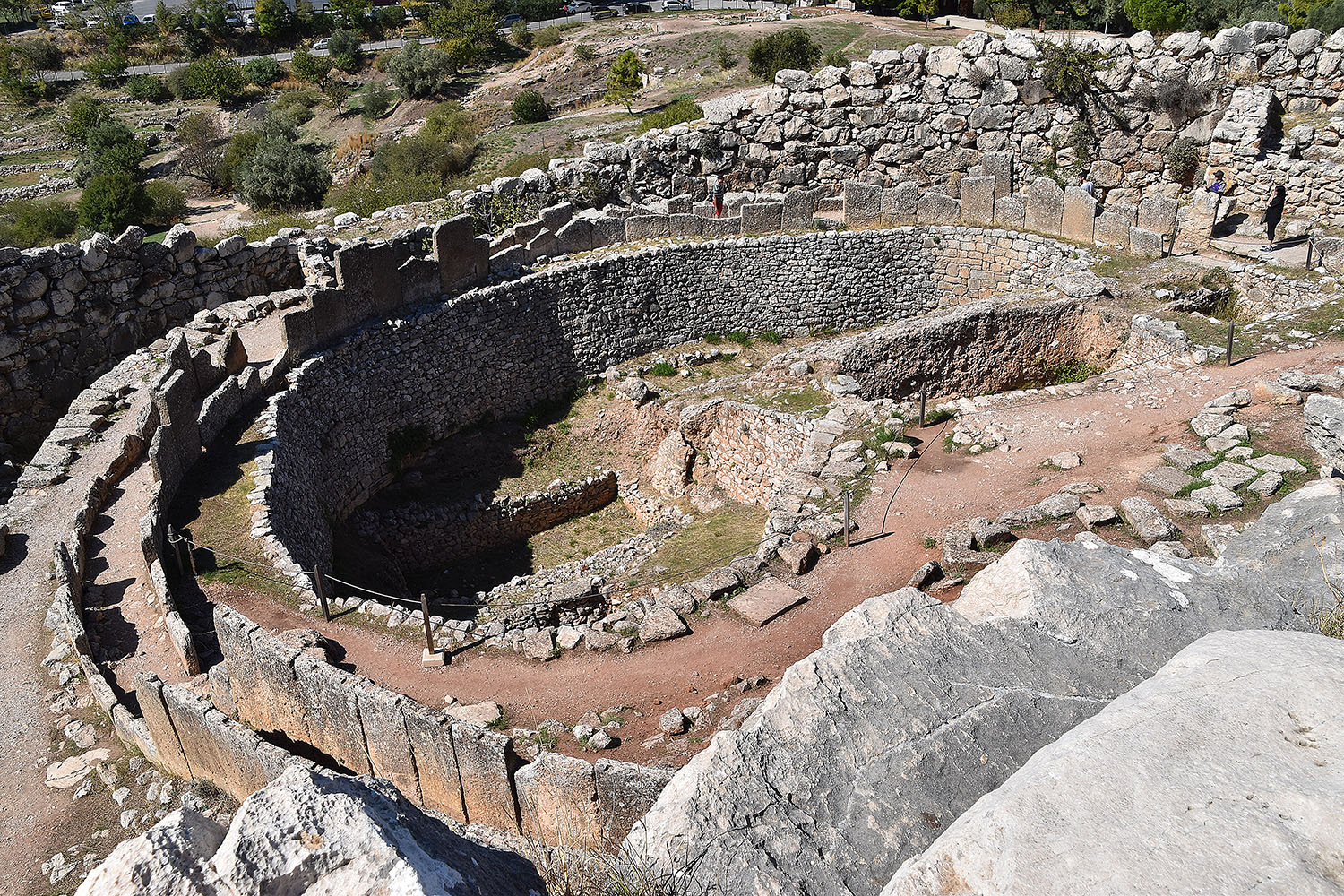
7 meters thick cyclopean defence wall of Tiryns, a fortress build in Agamemnon’s time
cyclopic
cyclopic
The entrence to the Treasury of ArteusInside the Trasury of Arteus: an increadable acoustic if you stand right in the centre of the domeThe entrance to Mycenae with the famous lions and the cyclopean wall
On Tuesday, October 6, we continued our journey north to Corinth, visiting on the way the important historic sites of Tiryns in the delta plain of Argos and Mycenae, the city and castle of the mythic King Armageddon, who triggered and lead the Greek campaign against Troy.
Tiryns is situated at the small hill dominating the plain of Argos, to day amidst large orange groves. The oldest archaeological findings date back to the 16th CBC and belong the Mycenaean period. Impressive are the cyclopean defence walls of up to 7 meters depth and 13 meters height built of huge (cyclopean) block of stones.
The tombs in MycanaeThe palace ground in Mycanae with a spectacular view to the plain of Argos and Nafplio
The fortress of Tiryns seems to be in close historic link to the fortress, castle and city of Mycenae that lays at the fringe area of the plain of Argos. Mycanae is one of the most important place in Greece’s ancient history. The site was discovered by Heinrich Schliemann, who also found Troy in today’s Turkey (close Cannakkale, south of the Dardanelle). The history of the site goes back to the 2nd millennium BC. The name of the place stems from the people settling in the region prior to the immigration of the Greeks from the Balkans. An important change in the local culture took place in the 16th CBC under the influence of the Egypt and Minoan/Cretan cultures introducing new techniques using gold in art work (e.g. the gold mask that Schliemann wrongly though to be that of Agamemnon). Huge tholos tombs (e.g. the Treasury of Arteus) were erected. Famous is also the lion portal. The Mycenaean period has come to an end in the 11th CBC with sea people invading and finally the Dorians taking over.
Von Finikounda nach Sparta mit Stop in Mystras Samstag 3. Oktober
Wir sind heute nordwärts von Finikounda über Kalamata nach Sparta gereist. Nach Kalamata führt die Strasse übers Gebirge.
Der Peloponnes hat neben den Küsten auch wilde, grüne, steinige, von canyonartigen Tälern durchfurchte aber fruchtbare Berglandschaften zu bieten. Wir haben auf unserer Fahrt das Taygetos-Gebirge überquert.
Im Wikipedia gefunden:
„Um den Taygetos ranken sich zwei Ereignisse aus der griechischen Sagenwelt: Hier sollen Zeus und Leda die Dioskuren gezeugt haben. Außerdem soll dieses Gebirge als Todesstätte für schwache Kinder aus Sparta gedient haben: Die Väter von Kindern, die mit Mängeln geboren wurden, waren verpflichtet, diese in eine Felsspalte des Bergmassivs in der Nähe des heutigen Sparta zu stürzen.
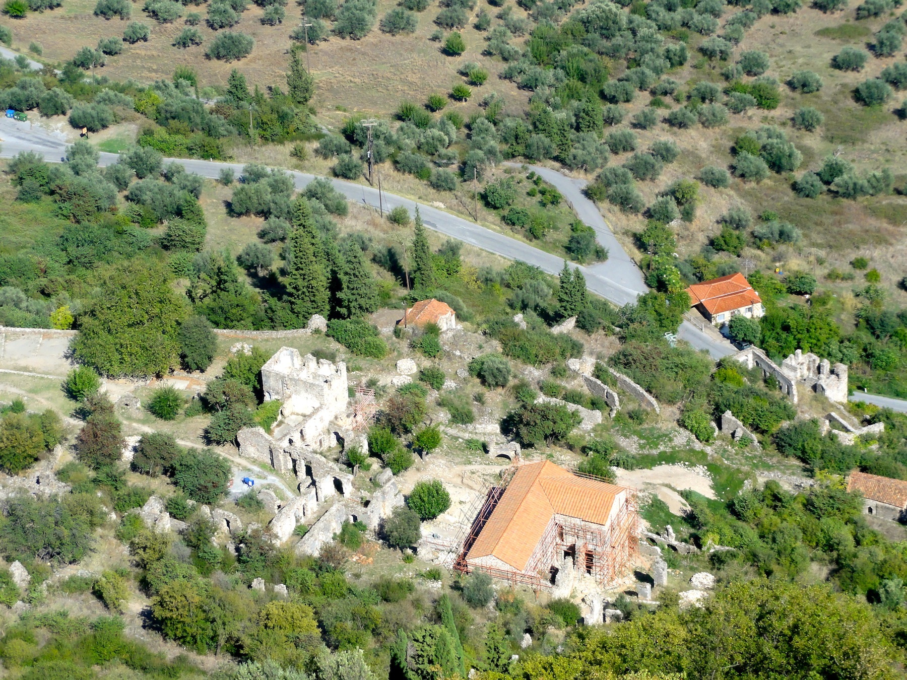
In Mystras haben wir eine längere Pause eingelegt, um die bedeutenste byzantiniische Ruinenstadt auf dem Peloponnes unter die Füsse zu nehmen. Sie liegt an einem Steilhang. Hochsteigen und zwischen den Ruinen wandern ersetzt fast eine Bergtour.
In Finikounda from September 28 to October 2, 2015
The last few days we took rest in the South of the Peloponnese in the small fishermen and tourist village of Finikounda. We hired a small room directly at the sea. The water was clear and dark blue. The temperature moderate – the heat we experienced in Iran and Turkey has gone. The light was still marvellous and unique, typically Greece in autumn, the colours of the nature sometimes bold and bright, sometimes in pastel. Still in autumn, the vegetation is full of flowers in all their colours.
Most of the tourists have left, only those few who could afford it are still here, mostly the retired people in the golden age. We spent our time at the small beach, directly in front of the hotel or hiked along the coast to discover hidden corners and beaches where we could sun bath, swim and dive only the two of us. In the evening we enjoy the local cuisine, Gabi goes sometimes for Fish and Calamari, both for Greek Salad, Tzadziki, Mousaki and many things more, of course, Greek wine.
Let us share some of the photos without further comments showing the vegetation, the nature and other things we have come across.
Das Wetter und das Meer, das Essen und die Leute
In Griechenland regnet es nicht; ist unsere Vorstellung.
Der Peloponnes ist jedoch sehr gebirgig und überraschend grün, olivgrün. Riesige Flächen an der Küste und im Vorgebirge sind mit Olivenhainen bepflanzt; die einen uralt und die anderen neueren Datums. Oliven brauchen Wasser und das scheint in diesem Teil von Griechenland reichlich vorhanden, aus Quellen und gelegentlichen Regenfällen.
Es gibt kein Essen ohne Oliven. Diese sind ein Leckerbissen. Nicht zu vergleichen mit den Oliven aus dem Büchsen. Auch der wohlschmeckende dicke griechische Joghurt gehört einmal im Tag auf den Tisch.
Das mit den Würsten ist Ruedi`s Teller
Ich darf auch einmal Kalamares essen, wenn der Tisch genug gross ist, so dass Ruedis Teller nicht zu nahe stehen muss.
Die Griechen, ja sie sitzen gerne beim Kaffee, sprechen eher laut, wenn sie miteinander diskutieren, scheinen sich nicht überaus anzustrengen, um die „Krise“ zu überwinden.
Von 14:00 Uhr – 16:00 Uhr wird Siesta gemacht und der Arbeitsrhytmus mit vielen Pausen unterbrochen.
Die griechischen Katzen sind überall dort wo Essen auftaucht im öffentlichen Raum. Ich wollte eine halbe Portion Kalamares bestellen weil die Prortionen immer eigentlich für zwei Leute reichen. Der Wirt sagte mir aber, ich könne ja mit dem Rest die Katzen füttern. Ich tat es nicht aber viele andere Gäste werfen den aufdringlichen Schmusetieren ihre Reste vor. Die Katzen werden von den Einheimischen geduldet, nicht gehätschelt, pro Forma von den Tischen vertrieben, aber gefüttert. Sie gehören zum Dorfbild als immer miauende, streunende Wesen.
Wir haben den Peloponnes über die 2250m lange Schrägseilbrücke, an der engsten Stelle des Golfes von Korinth, von Rio nach Patras erreicht. Von Patras mit dem grössten Fährhafen Griechenlands, werden wir dann nach Italien übersetzen, wenn wir unsere Tour auf dem Peloponnes beendet haben.
In Patras
In Kalavryta, einem Wintersportort am Fusse des 2300 Meter hohen Chelmos Gebirges haben wir Regen und Nebel erlebt und sind vom Wandern abgehalten worden.
Die Fahrt von dort nach der Westküste ist von der Strassenführung her spektakulär, wie eine Tremola nach der anderen, aber entlang von steilen tiefgünen Hängen und felsigen Hügeln. Erreicht haben wir den touristischen Ort „Olympia“ mit den Überresten des antiken Olympia (Ruedi berichtet darüber)
Wenn man hier durch die kleineren umliegenden Dörfer fährt, liegt Abfall überall herum, aufgetürmt in Plastiksäcken aber auch verstreut am Strassenrand und in Gassen und Feldern. Die Krise??? Ja, offenbar muss der Zentralstaat sparen und gibt weniger Geld an die Gemeinden. Viele haben sich jedoch organisiert mit Eigeninitative und Geld von der Bevölkerung für die Abfallentsorgung eingetrieben. Die Gemeinden um Olympia scheinen dieses Problem nicht lösen zu können.
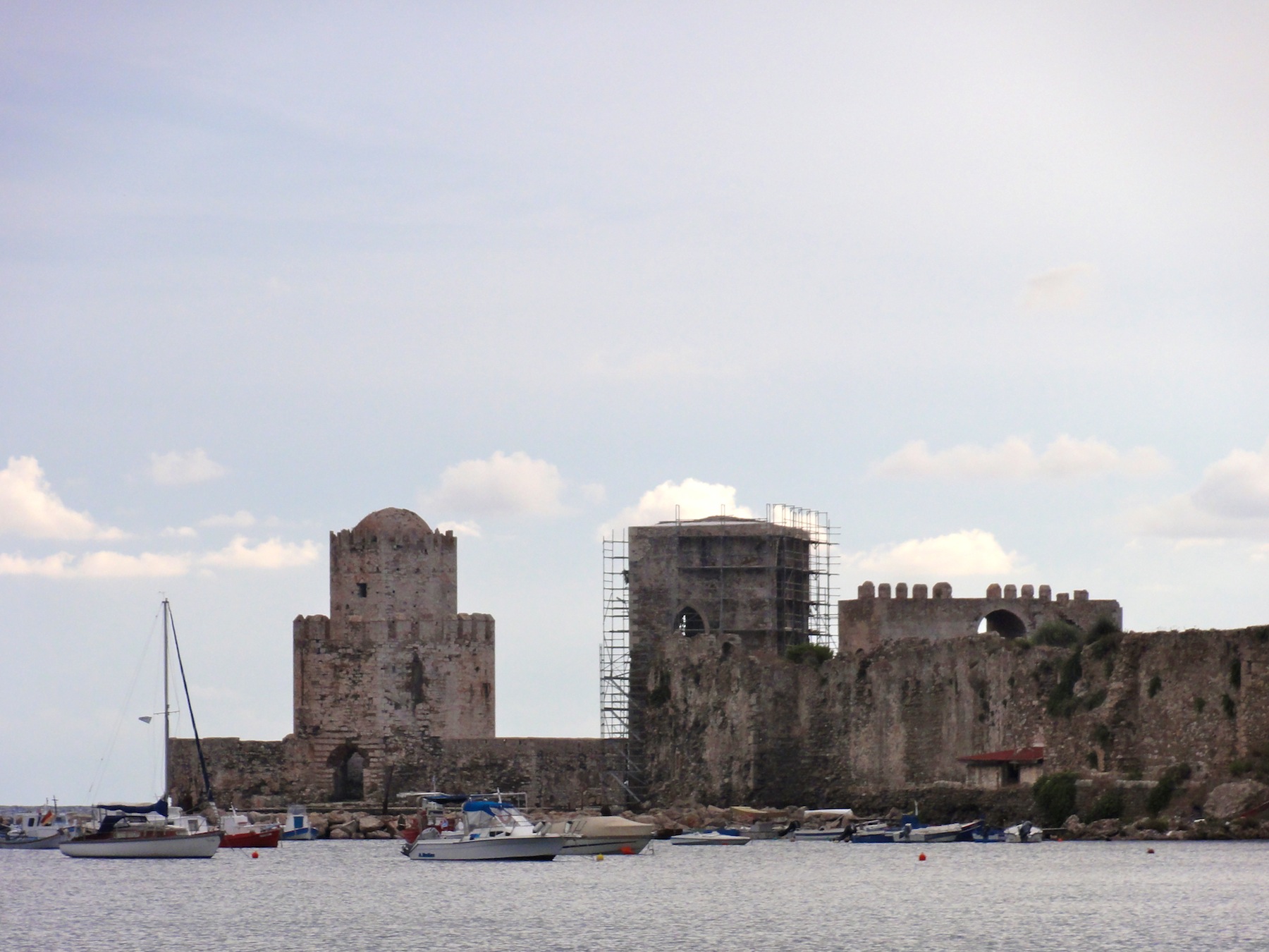
Wir geniessen die wieder sonnigen Tage an der südlichen Küste des Peloponnes in einer kleinen Bucht mit ein paar Hotels und Tavernen. Zuerst eine Nacht in Methoni, mit einer grossen byzantinischen Burganlage
und jetzt in Finikouda, einem kleinen Fischerort.
September 26, 2015: Ancient Olympia and its reinvention.
Rain in the central hills of the Peloponnese
The weather forecasts given on our iPhone did not promise anything good : no sun was displayed, only clouds with rain, for this and the days to follow. And in fact, the trip downhill from Kalavryta, the Peloponnese ski and hiking resort, was covered with deep dark clouds and one wet storm gust followed the next. Originally we wanted to hike along the river Styx, the mythical river of the underworld in Homer’s legends where Achilles has been bathed by his mother and got inviolableness except at the right heel where the mother had to hold the baby (and the Achilles heel was the place where Paris hit him with his arrow that was led by Apollon).
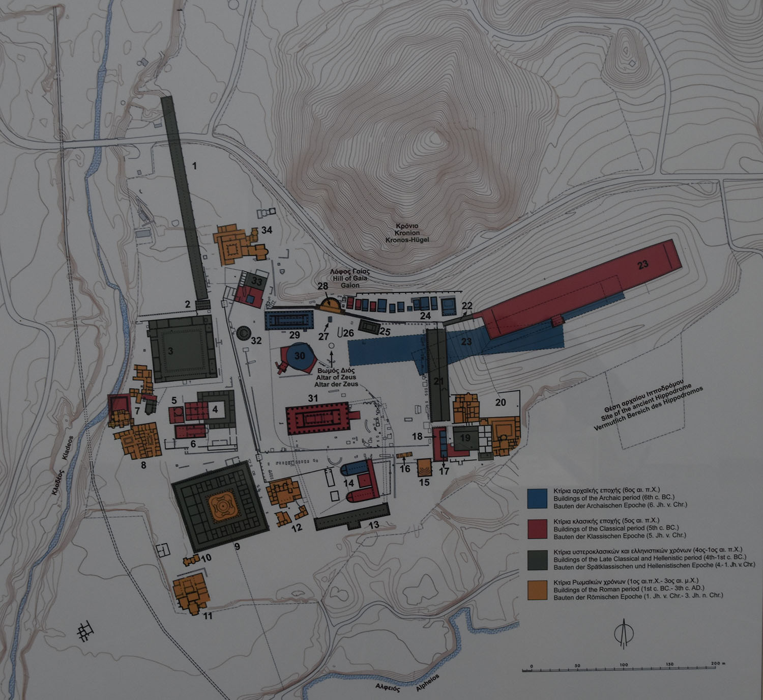
Model of the Olympic sanctuary with the Stadium in the BackgroundMap of the Olympic sanctuary
While driving the hills downwards through a beautiful, however wet landscape we reached Olympia in the early afternoon, the place where for more than thousand years the ancient Olympic Games have been carried out till the Christian Roman Emperor Theodosus I. has forbidden them as a pagan festival end of the 4th century. The Olympic complex is placed is in a junction of two rivers, and the surrounding is rich and green with large trees, orchards and reeds all over.
The region of Olympia is an old inhabited area dating back to the 3rd and 2nd millennium BC. According to the legend, the games were invented by Heracles. Historically they are the first time mentioned in the year 776 BC when a contract was set up declaring peace during the games. From that date onwards, the winners of the game have been recorded and their names inscribed in the stadium. This was also the beginning of the Greek time reckoning.
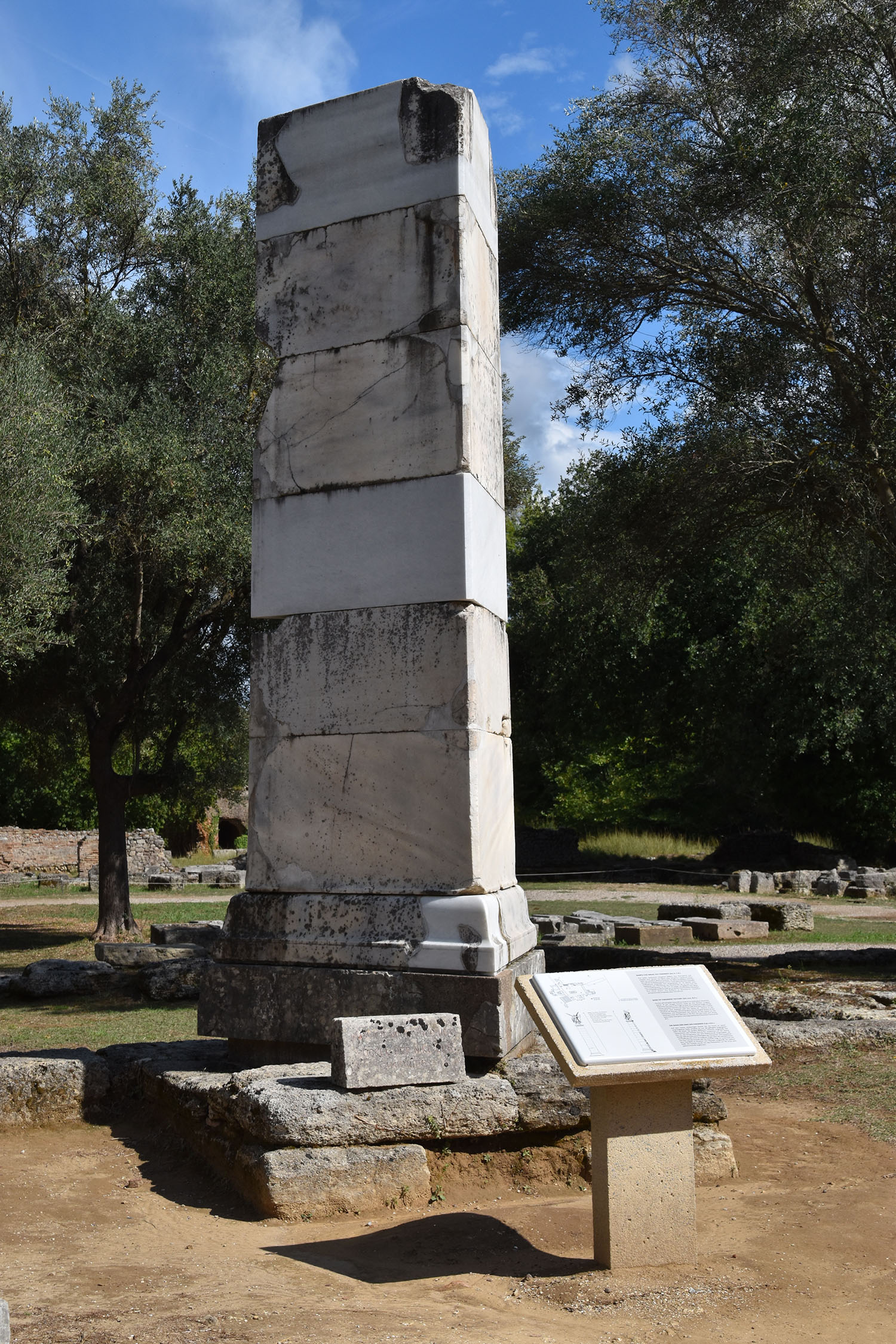
Temple of Zeus. One of the 12 meters high columns has been re-errected.The Olympic Stadium for 45’000 spectators
Olympia has been a Pan Hellenistic festival in favour of the Gods, particularly Zeus, and has been carried our every 4th year. The games included six major disciplines, namely foot race, wresting, fistfight, pankration (everything is allowed in the fight, excluding biting and scratching), pentathlon, and horse disciplines.
The Philippeion, end of 4th century, was donated by the Macedonain King Philipp II, the father of Alexander the Great, after the battle of Chareonea.
Today, the holy area of the Olympic
Base of the Paeonios‘ Victory (5th century BC). The base is 9 meters high and the winged Victory 3 meter, thus the sculputre has reached a total hight of 12 meters.Emperor Nero’s residence when he visited the games in 69 BC
Games are a vast expanse of ruins. In those days it included a large number of different large and beautifully decorated buildings, such as the temple of Zeus, temple of Hera (the wife of Zeus), training centres for the athletes, guest houses, building of the Olympic council, treasury houses with the offerings of the state cities, and, of course, the stadium. With the prohibition of the games, the large building complex started to fall apart and earthquakes has given the rest, particularly to the temple of Zeus when the large 12 meters high columns collapsed. Anyway the statue of Zeus sitting on his throne, one of the seven world wonders that was built by Phidias out of stone, ivory and gold, was removed end of the 4th century to Constantinople and is missing since.
Palaistra (training area for wresting, boxing and jumping) with an inner central court surrounded by colonnadesThe place where the holy flame has been burning in acient time. Nowadays, the torch is brought from here around the world to the City that carries out the modern Olympic Games .
Many of the statues and reliefs as well as items from the treasury houses that have been found during the excavation are kept in the Olympic museum next to the holy precinct. The excavation of the French Historian Pierre de Coubertin in the 19th century initiated the reestablishment of the Olympic Games that has been carried out the first time in Athens in 1896.
Hermes and the Infant Dionysus discovered in the temple of HeraApollon from the Temple of ZeusOne of the figures of the west Pediment of the temple of ZeusFigure of the old diviner from East Pediment of the temple of ZeusHera helping Hercules to carry the worldFigure from East Pediment of the temple of ZeusFigure from the East Pediment of the temple of Zeus
September 24, 2015: Delphi – at the naval of the world
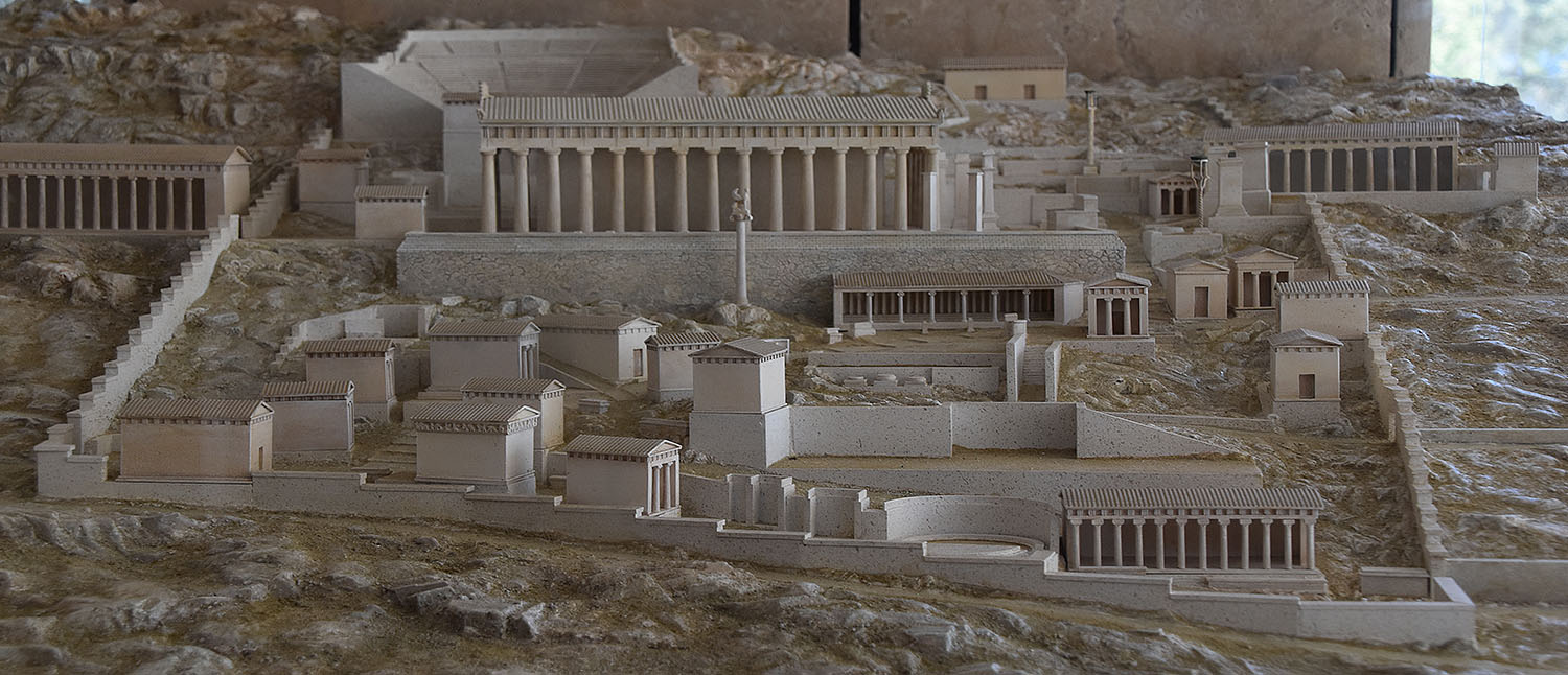
View from the slopes of the Parnassus down to village of Itea at the Golf of CorinthThe magnificant setting of Delphi in the Parnassus mountain range. In front the temple of Apollo and behing the rocks where the holy Kastalian Spring emerges.The Omphalos, the naval of the Earth. It used to stand where the prophetic responses were given via the Pythia.
Delphi needs to be understood in its grandiose landscape embedded into the southern slopes of the mountain ridge of Parnassus overviewing a deep south-east extending valley of the green, wild and rocky escarpment leading down to the Golf of Corinth. We stayed overnight in the picturesque seaside village of Itea. Travelling to Delphi we followed the road north through extended olive plantations to the serpentines that brought us up to the sanctuary.
In myths the site of Delphi was believed to be determined by Zeus when he sought to find the centre of his ‘Grandmother Earth’ (Ge, Gaea, or Gaia). He sent two eagles flying from the eastern and western extremities of the earth, and the path of the eagles crossed over Delphi where the Omphalos, or navel of Gaia, was found.
Delphi seems to have already been a sacred place of an important oracle in a pre-classical period of the ancient Greece (as early as 1400 BC) and was rededicated to worship Apollo around 800 BC. Earlier myths say that Apollo has slain Python, the son of Gaia and a dragon with prophetic abilities, who protected the navel of the Earth. With the blood shed by Python the prophetic abilities has been transferred to Apollo, who subsequently has become the master of the oracle. Apollo talked to the advice seekers through the Pythia, a women priest. She has been sitting in the temple over a small crevice out of which narcotic vapours emerged that put her in trance. The recipient of the prophetic messages thanked with offerings that were kept in special treasuries in the Delphi sanctuary.
The model of the holy area of DelphiTreasury of the AtheniansThe Kastalian springs providing the water for purification before entering the holy area. The myths tells that Apollo cleaned himself after he had slain the Dragon Pythia.
Apollo’s precinct was a Pan Hellenic sanctuary. It had its golden age in the 7th and 6th century BC and again under the Roman Emperor Hadrian in the 2nd century AD.
Gifts to Delphi (from the King of Troy?)The monumental temple dedicated to Apollo and where the oracles have been received
Gabi and I followed the ancient ‘holy street’, first with ‘cleaning’ at the purifying Kastalian spring water (i.e. drinking water and cooling the face and neck – it was a very hot day). In ancient times everyone had to do the cleaning rituals before entering the sanctuary. However
About 560 BC the mythical Sphinx has been offered by the King of the Naxos island . The Sphinx is to be warding off evils. In total, column and statue had a hight of 12.5 meters.Decorations from the Apollo temple
we could not visit the holy water source itself due to dangerous regular rock falls. The holy street thereafter entered the sanctuary, following the treasury houses which included the offerings given by the hellenistic states.
Figures made out of silver (gifts by a King of Troy?)Amphitheatre with around 5000 seatsThe athletic statium on the top of the holy area
The centre of the sanctuary is taken by the temple dedicated to Apollo, the god of the oracle, music, harmony and light. Above the temple, the theatre is located, with a capacity of around 5’000 spectators enjoying a magnificent view to the entire valley. Musical and dramatic contests of the Pythian Games – see below – and other religious festivals were held here.
On the top, outside of the holy precinct, at the foot of the rock face, we find the stadium in which the athletic competitions of the Pythian Games were performed. They were of second importance to those in Olympia on the Péloponnèse island. The tracks for the running competitions were marked by stone slaps. The distance between start and finish was one Pythian Stade, equivalent to 178.35 meters. The Pythian winners were awarded with a palm tree twig or a wreath of laurels.
The Twins of Argos, monumental votive offeringsThe Charioteer in bronze
The visit to Delphi was for Gabi an me one of the most impressive excursion mainly due to the magnificent setting of the sanctuary in a spectacular landscape that allows deeply to dive into the historic Greek and Roman period, feeling the strength and spirit of this special place that has shaped the political destiny of the antique Mediterranean world during one thousand years.
September 21, 2015: Dion – the Sacred Place of Zeus and Holy City of the Macedonian
One of our wishes during our travel through Greece has been to visit and to hike in the lush green wilderness and deep gorges of the Mount Olympus, the highest mountain of Greece with 2’919 metres altitude, and considered the seat of the twelve Olympians, namely Zeus, Hera Poseidon, Demeter, Athena, Artemis Aphrodite and others, thus the major deities in the ancient Greek pantheon. In the morning when we were levaing Thessaloniki the sky has shown clouds for the first time during our travel and at noon it started to downpour. The weather forecast was not very promising with at least five days of continuous rain in North and Central Greece. We decided to wait and to see and thus to stay close the Mount Olympus at the beach resort in Leptokaria – maybe the weather gods will have pity with us and bless us with some sunshine. This hope was in vain. It continued to rain throughout the day as well as the day after.
On the way to this Leptokaria we visited the excavation site of Dion in the region of Pieria in the footplains of the Mount Olympus. In the ancient time, Dion was the most southern Macedonian border fortress and a holy city. The name derives from Dios, the site of Zeus.
The Dion excavation site is situated in a large park area over several hectares. Well laid out footpaths and informative signposted with explanations makes the visit to a real pleasure.
Muskrat in the holy springs of DionWater penetrates from underneath into large waterpoolsHoly pools as water source of the Zeus sanctuary of Dion
In the large water pools and springs we could observe muskrats and many birds. The village Dion has a nicely arranged museum in which the statues and many other artefacts of the excavation site are kept.
The abundant water sources that till today inundates the area of Dion were the decisive reason for the place of the sanctuary. Water was a basic element of the cult of Zeus, who was associated to weather phenomenon, nature, fertility and healing.
The Hellenistic Amphitheathre with the plain on which Alexander the Great prepared for his Asia ExpeditionAlexander the Great’s Expedition to Asia around 320 BC
Dion was regularly visited by the Macedonian kings. King Philipp II (the father of Alexander the Great) came to sacrifice to Zeus for ceremonial purification of his armies and to celebrate his victories. Alexander the Great started his campaign to Asia in Dion with sacrifices to Zeus and celebrations. The place flourished during the Hellenistic and Roman Imperial time till the 4th century AD. Repeated earthquakes destroyed the sanctuary, obliging the inhabitants to abandon their houses.
King Archealos (413-399 BC) constructed a temple for Zeus, a theatre and a stadium for Olympic Games in competition to the games in Olympia (in the Peloponnese). Dion has been the most important centre of cult in Macedonia.
The head of Demeter in the Museum of DionThe Temple of ArtemisTemple of Artemis (?)
A series of temples were devoted to the goddesses of fertility, above all Demeter, the ‘Mother Earth’. The great festivals were held in October, in the season of seeding. Women, who were the main actors, initiated the sacred rites celebrating the fertility of the earth and the women.
Other important temples was dedicated to Aphrodite and Artemis. Alexander the Great held Artemis in his highest esteem. In the 2nd century BC, Artemis was succeeded by the Egyptian goddess Isis, specialised on protecting women after childbirth. (In our blog about Ephesos we wrote that Alexander the Great wanted to finance the rebuilding of the Artemis temple after a fire accident. But the people refused and found an excuse to turn him away.)
Excavations disclosed most of the ancient city with its defence walls, main and ancillary streets, many of them laid out with large stone slaps and lined with columns. Large public bath buildings with beautiful mosaics, clay water pipes, public toilets, private villas – the latter from the Roman period – were found.
Mosaic from a private VillaA hydroulic music intrument, the ancestor of the organ (Museum of Dion)The bronce head of a Roman (Museum of Dion)
Fahrt nach Leptokaria mit Zwischenhalt in Dion, 21. – 23. September
Unsere Idee ist es, den Peloponnes zu befahren. Auf dem Weg in den Süden wollen wir ein paar Küstenorte kennenlernen. Vielleicht finden wir auch unseren ersten Campingplatz, für ein paar Tage am Strand.
Bis jetzt macht das Wetter uns einen Strich durch die Rechnung. In der letzten Nacht in Tessaloniki hat eine Regenfront Griechenland erreicht und starker Regenfall hat offenbar auch Athen in Probleme gestürzt (haben wir am Fernseher gesehen). Auf der Fahrt nach Leptokaria, ein Küsten-Ort am Fusse des Olymp, hat ein Regenschauer nach dem andern die Lust und die Sicht auf den Berg getrübt. Ruedi wollte eigentlich den Olymp besteigen.
Eine braune Hinweistafel für historische Stätten an der Autobahn hat uns dann nach Dion gelotst. (Ruedi wird darauf eingehen)
In Leptokaria finden sich zahlreiche Apartment/Hotels. Wie wir am Abend beim Regenspaziergang gemerkt haben, treffen sich hier vorwiegend Serben und Bulgaren für alljährliche Badeferien.
Das Regenwetter und ein schönes grosses Hotelzimmer haben den Vorteil, dass wir heute (22. September) Lust und Zeit in Hülle und Fülle haben, um diesen Text zu verfassen und dann hoffentlich auch erfolgreich in den Blog zu stellen. Die Verbindung zum Internet ist on und off.
Griechenland und Regen, was für eine unerwartete Situation.
Thessaloniki / Kavala, 19. – 20. September
Auf dem Weg nach Thessaloniki, der zweitgrössten Stadt in Griechenland machen wir einen Halt in Kavala. Der Ort liegt am Meer, ist am Hang gebaut und wird überragt von einer Zitadelle. Die Stadt ist sehr eng gebaut. Dies gilt nicht nur für die Altstadt, die grösstenteils renoviert und sehr farbig ist. Die Häuser sind mit Pflanzen geschmückt, Details mit Liebe gepflegt.
Eintritte für Museen und Denkmäler sind relativ günstig (wir bezahlen den Preis für Pensionierte).
In Thessaloniki angekommen finden wir ein 25€ Zimmer in den engen Gassen des Hotelviertels. Es ist Samstag, die Läden sind früh geschlossen aber die Bevölkerung und die Touristen am Abend alle unterwegs im Restaurantviertel oder am Boulevard. Aus verschiedenen Ecken tönt Musik, lautes Gespräch und das Geknatter von den vielen Motorrädern. Feste werden gefeiert, spezielle Märkte in Parks oder grossen Plätzen ziehen die Besucher an.
Byzantinisches HamamAgios Dimitros Kirche, grösste Kirche Griechenlands
Die Stadt wirkt lebendig und die viele alten geschichtlichen Gebäude und Überreste sind über die Stadt verstreut und in die Neustadt integriert. Der Stadtplan zeigt die sehenswerten Orte mit kleinen numerierten Punkten in verschiedenen Farben (nach Zeitepoche unterschiedlich) und wir legen einige Kilometer zurück, um nur einen Bruchteil gesehen zu haben.
Romakinder versuchen ihr Glück mit der Handorgel und ziehen am Abend von Tisch zu Tisch.
Das Griechische Essen mundet uns: Salate, Mussaka, Uso, Gemüse und alles mit einem kleinen Extra vom Haus am Ende.
Canakkale nach Nea Karvali, 18./19. September
(Please note that the blog on Patara, Xanthos and Ephesos has been updated below!)
Um für Griechenland vorbereitet zu sein, haben wir in Canakkale Dollar in Euro gewechselt. Der Wechselkurs war sehr schlecht, aber immer noch besser, als die Kommission, die die griechischen Banken verlangen für den Bezug von Euro mit der Karte am Bankomaten (50.-CHF für 600Euro).
Die Überfahrt über die Dardanellen dauert 20 Min. Auf der europäischen Seite wirkt der Ort Eceabat verschlafen und weniger touristisch aufgemöbelt. Die Halbinsel wird als Tagesausflugsziel mit ein paar historischen Punkten aus dem ersten Weltkrieg besucht.
An der Grenze Türkei/Griechenland sind wir nicht einmal aus dem Auto ausgestiegen. Der Ordner mit all den Autopapieren brauchten wir nicht zu öffnen. In 15 Min. sind wir von der türkischen Seite in Griechenland eingereist.
Die Berge und Hügel sind mit Föhrenwäldern bewachsen.
Für die Autobahn bezahlt man eine Maut.
Im Hotelpreis ist das Frühstück nicht inbegriffen.
Der Diesel ist billiger.
Griechisch tönt im ersten Moment ein bisschen wie spanisch.
Es gibt guten Kaffee in allen Restaurants und Cafes.
Viele Griechen spazieren mit einem Pappbecher und Röhrli mit Kaffee auf der Strasse.
Am Abend sind die Kneipen am Boulevard voll mit Leuten, die es sich gut gehen lassen beim Essen und Trinken.
greek crisis / no job / no money / no problem. So steht es auf dem T-shirt eines waiters.
Erste Übernachtung in Nea Karvali, im Hotel Akontisma. Das kleine neue Hoteldorf (alles kleine Steinhäuser, die als Hotelzimmer umgebaut sind) steht auf einem Hügel ausserhalb von Nea Karvali, wo in der Zeit von 300 vor Christus bis nach dem ersten Weltkrieg ein Händlerdorf, später eine militärische Festung, dann ein Bauerngut und Erholungsort mit Han für die Handelseisenden, ein Zufluchtsort für verfolgte Christen aus Kapadokien war.
Die Sommersaison ist nun vorbei. Wir sind die einzigen Gäste.
Von Selcuk/Ephesos nach Canakkale 16. – 18. September
Nach einem in historischer Hinsicht reichen Tag in Selcuk (Besuch von Ephesos, Ruedi berichtet darüber) fahren wir der Grenze zu Griechenland entgegen. Ein bei längerem Überdenken sehr komischer Zwischenfall, der uns Zeit und Geld kostet, verzögert die Fahrt nach Canakkale.
„„Ein Mechaniker hat ein Problem am rechten Hinterrad unseres Volvos festgestellt beim Hinter-uns-Herfahren. Es gelingt ihm, uns zu stoppen und auf türkisch uns zu erklären, dass wir so nicht weiterfahren könnten. Er kriecht unter das Auto und findet Öl am Rad. Wir sind überrascht und folgen ihm, langsam fahrend zur nächsten Ausfahrt, wo wir das Auto abstellen und er sofort mit dem nötigen Werkzeug das Rad abmontiert, sehr professiell. Er zeigt uns, dass Bremsflüssigkeit herausgeflossen ist an einem Ort, wo diese nicht ausfliessen sollte. Er demontiert einen Teil der Bremse und fährt weg. Ruedi wollte mit ihm in die Garage fahren; er jedoch überzeugt uns davon, dass es gefährlich sei, mich allein beim Auto zurück zu lassen. Nach einer halben Stunde ist er zurück mit einem neuen Bremsteil und montiert ihn. Der alte Teil sei nicht zu reparieren und wir fragen auch nicht danach. Wir sind froh, ist der Volvo wieder startbereit. Der Spass hat uns 260$ gekostet, für türkische Verhältnisse ein guter Preis. Wir fahren los, Canakkale entgegen, während uns diese Geschichte noch 2 Tage beschäftigt und wir je länger je mehr davon überzeugt sind, auf einen Arbeitsbeschaffungstrick hereingefallen zu sein. Wir werden es nie genau wissen.““
Der flinke Mechaniker bei der Arbeit
Canakkale
Beim Hereinfahren in diese Stadt an den Dardanellen entdeckt Ruedi eine Volvo Vertretung. Seit dem Vorfall im Iran (Benzin statt Diesel), wollte Ruedi den Volvo auf Spätfolgen absuchen lassen und nun zusätzlich die Bremse untersuchen lassen. So bleiben wir zwei Nächte und geniessen den letzten Tag in der Türkei (nachdem auch alles ok ist beim Volvo).
Canakkale ist heute ein reger Fischerhafen, ein Fährhafen und Startplatz für Flüchtlinge nach den griechischen Inseln, war und ist ein strategisch wichtiger Ort als Zugang zum Marmara- und dem schwarzen Meer. Die Stadt ist stolz auf die Geschichte der Marine, die 1915, vor 100 Jahren, den fränzösischen und englischen Angriffen standgehalten hat. Ein Museum zeigt die Schlacht um die Dardanellen ausführlich und ehrt die wichtigen Generäle.
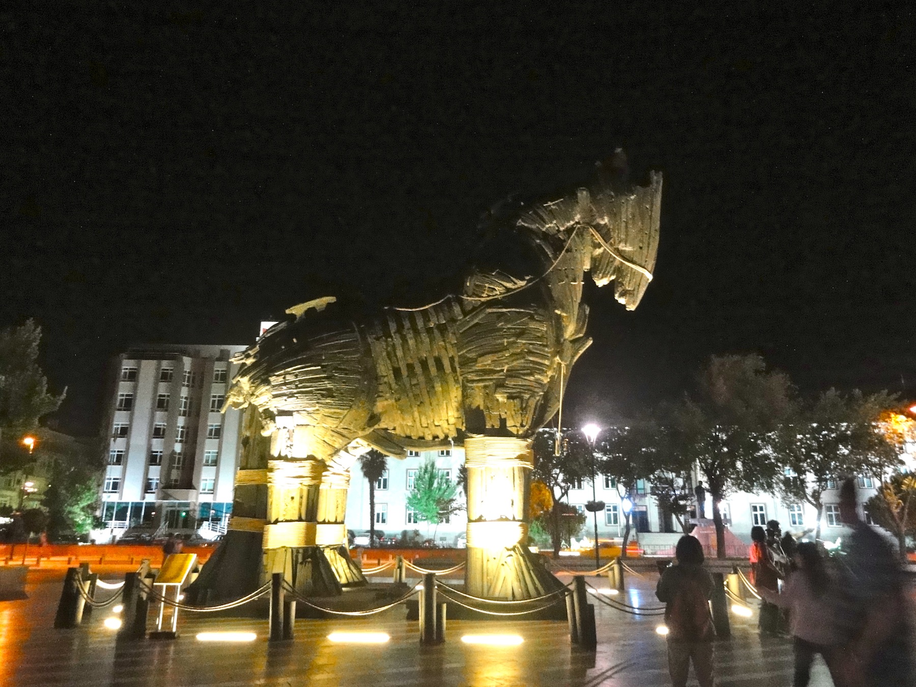
Das troyanische Pferd aus dem Film Troya mit Brad Pitt steht auf dem Hauptplatz in der Stadtmitte. Die Ausgrabungsstätte der Stadt Troya liegt ca 25 km südlich von Canakkale.
Den letzten Abend verbringen wir im Boulevard-Restaurant eines Türken, den Ruedi in der Volvogarage kennengelernt hat und der ein bisschen englisch spricht. Es läuft der Europaleague Fussballmatch Fenerbace (Türkei) gegen Molde (Norwegen) und wir trinken Raki.
The visits to the ancient site of Patara and Xanthos as well as Ephesos have been another highlight of our tour through Turkey. Physically and mentally strengthened by the break in the holiday resort of Kaleüzagic we were ready again to concentrate on the rich history represented in carved stones, rock pillars and settlement ruins from ancient times.
Amphitheatre in PataraThe first parliament of the world had its sessions in this building in PataraMain street in Patara
We dedicated our first visits to Patara and Xanthos. Both sites belong to the Lycian civilisation which had its origin in the coastal region of Kekova (where we went to rest, hike and swim with the water turtles). The Lycian people exists since the 12th century BC, the first written indications are in Homer’s Iliad in relation to their participation in the war against Troy. The Lycians belonged to many different empires, including the Persian, the Egyptian, the Greek and the Romans. In 168 BC they were left into independence and they founded the Lycian confederation of 23 independent city states. The six largest were Xanthos, Patara, Pinara, Tlos, Myra and Olympos; Xanthos and Patara are situated good 60 kilometres southeast of Fethiye.
Basilica from Bycantine’s periodView from Xanthos to plaine covered with green houses for vegetable productionAmphitheatre in Xanthos
The Lycian confederation is mentioned as the first democratic union in history. The house of assembly (buleuterion) in Patara is considered the first parliament on the world. The Lycian confederation was instrumental for freedom lasting one hundred years. It found its end when the union decided to refuse paying its tribute to Brutus (the murderer of Caesar), who supported Lycia during a civil unrest. In 42 BC, Brutus occupied Xanthos after the defeated people have undergone collective suicide in order not to surrender (the second time after their defeat against the Persians around 450 BC).
The Lycia confederation did not leave behind many written documents, however stunning sarcophaguses and cave and house tombs (see photos in the section on Kekova/Kaleüzagic).
Xanthos includes a large amphitheatre, the famous Nereid monument (today in the British Museum in London), Basilicas stemming from the early Christian period and the seat of the Bishop in Byzantine’s epoch.
Thousands of visitors from all over world in the Souvenir market in front of EphesosThe central Amphitheathre in Ephesos with seats for 21’000 spectatorsThe Celsus Library in EphesosStatue in the Celsus Library
The most impressive visit, however, has been to Ephesos. While in most of the historic sites visited we were more or less on our own. In Ephesos, however, we were among thousands of visitors from all over the world (creating a Babylonian language confusion). In front of the entrance, Syrian refugees as ‘flying vendors’ sold local souvenirs to earn some money for their onward escape to Europe.
Private VillasFresco in a private VillaMosaic in a private VillaA resent net of wood wasps in an antique surrounding
Modern pilgrimage along the Curettes Road to the Isis/Artemis TempleIsis/Artemis Temple in Ephesos
The Hellenistic and Roman culture impressively comes to live in this historic site. For the last 150 years excavations took place and made Ephesos to the completest antique place of discovery – and still 18% only of the former city that housed around 250’000 inhabitants is excavated.
Public toiletsRelief at the road side in EphesosThe main street leading to the ancient harbour
In Ephesos people met for trade and pilgrimage from all over the Mediterranean world and made the city rich and important. The most important temple was dedicated to Artemis, the goddess of fertility.
The first settlements of the place date back to the Neolithic time. The historically most relevant period of the place began in the 10th century BC with the Ionian king Androkklos, who founded Ephesos and integrated the Anatolian fertility cult in that of Artemis. In spite of many natural disasters and war destructions (by Lydians and Persians), the Artemis worshipping continued. Alexander the Great, who was a big admirer of Artemis (see the contribution on Dion/Greece, later on) wanted to rebuild the temple after a devastating fire accident. The people of Ephesos however refused thankfully with the clever argument that it is impossible to replace one god with another … The finally reconstructed temple was considered as one of the seven world wonders.
Carved Stone beamsHundreds of columns – to b sold?
After the death of Alexander, one of his generals ruled the region of Ionian and moved the city of Ephesos to the present place. The reason were problems with the harbour due to siltation by the river Menderes (Meander). The new location was strategically chosen between two hills. After a troubled time of war and changing luck, the Romans conquered the city 133 BC. In spite of high taxes the city prospered and has become the capital of the Roman Asia Minor. Economically and politically most important has been the yearly spring ceremonies of Artemis (or Diana for the Romans) that lasted one month and attracted thousands of visitors from all over the Roman Empire.
Ephesos has also become the city of attraction for the first Christians, such as Apostle John, who is told to have settled with the virgin Maria, to preach the gospel. Around 60 AD, also Apostle Paulus has lived three years in Ephesos.
Basilica/Church of MaryCarved slap in the Basilica/Church of Mary
In spite of strong efforts to desilt the harbour, it has become increasingly defunct and the surrounding of the city turned into a swamp causing malaria. The now Christian city lacked the income from the Artemis/Diana cult as well as from the sea trade. In 263 BC the Goths conquered the city burned down the temples. The Christian Roman Emperors tried their utmost to rebuild and maintain the most important buildings of the city of the two Apostles and Maria. In the 6th century the Emperor Constantine has built a large basilica, dedicated to the Saint John in today’s Selcuk (few kilometeres inland of the ancient Ephesos and where we stayed overnight) in the place called by the Greek Agios Theologos – the holy theologian. The crusaders in the 12 century wondered to find a little village instead of the famous antique Metropole.
Some Thoughts about the South Caucasus and Asia Minor – Iran and Turkey -, the Syrian Refugees and the Forthcoming Parliamentary Elections in Turkey
On our way back from Tbilisi to Uetikon am See, Gabi and I have the privilege to travel as retired service persons (or pensioners) comfortably and without any major real constraints back from Georgia to Switzerland, to a safe country and with a secured future ‘till the bell calls’. Of course, we have discussions about Swiss politics, sometimes even vigorously, and complain – but we complain at a very high level.
Looking back, we left a fragile and troubled region in the South Caucasus under massive pressure by Russia that interferes into the local politics by occupying parts of Georgia (Abkhazia and South Ossetia), compelling Armenia to join the Russian dominated Eurasian Custom Union and thus lowering the country to a quasi-Russian Republic and Azerbaijan that suffers under an autocratic and grossly human rights violating government with the President’s family stealing the country’s entire economic wealth to make it his own property. The social, economic and political future in all the three countries remain difficult with Georgia, thanks to the solid backup by Europe and the USA, having the best chance to overcome its current multiple problems.
In Iran, we experienced quite a different situation. After 35 years of isolation caused by the economic and political sanctions by the West in the aftermath of the Islamic revolution, the negotiations of the US with the Iran government levelled the way to lift the restrictions. We experienced a nation in its move. During our whole trip, people approached us straight forward and asked what we think about Iran, about its people. The questions most often voiced were: “Do you think that we are terrorists … what you think about us?” We got involved in many discussions. I remember for instance in the Blue Mosque in Tabriz with an English teacher and tourist guide, also in Tabriz the machine engineer, in Teheran the mining engineer, in Shiraz the tourism expert. All of them hope that now the ‘deal’ with the West will help them to connect to the world economy, to travel, to get recognised as cultural people – or in other words: to get back their due dignity. And indeed, Iran, has one of the richest cultural past of thousands of years, influenced by East and West. And thus Iran considers itself a linking bridge between the Eastern and Western world.
Politically, the country is astonishingly stable, considering particularly its troubled Southern and Eastern neighbours and the new problems recently emerging at its Western border. The economic disparity in Iran seems to be much more even compared to the South Caucasus (– we saw only one Porsche Cayenne during our stay …). What astonished us as well is the industrial capacity the country was able to develop and sustain in spite of the sanctions. Iran has altogether a very good infrastructure (roads, railway, metro, electricity, water supply, schools, health, etc.) in all the major cities we have been visiting. Iran, without the sanctions, will be a fast growing emerging economy.
Another factor we felt important is that the Islamic Revolution is dead. With whomever we talked, nobody was supporting the Islamic ideas (however women still wearing the head scarfs and were dressed with the traditional ‘uniform’ on the streets but had modern cloths under the black wrap). People informed us that 80% of the population are against the present regime, if there would be free and fair elections. Of course, we had only access to English speaking persons and our impression might been different, if we would have been able to communicate in Farsi and reach a better cross-section of people.
Crossing over to Turkey opened up another, quite different world. The economy is considerably more dynamic. The agriculture is fully mechanised with modern equipment. Even in rural areas, the smaller towns have industries in their outskirts, mainly agricultural processing plants and mechanics for agricultural equipment. The local bazars are places of hectic activities. Travelling in Turkey from East to West shows however still considerable economic differences. Comparing this, however, to my former travels to Turkey in the mid-1980’s to mid-90’s, the disparity has been considerably reduced and the overall economy has substantially improved. Large scale, sometimes abject poverty has disappeared. We were told by many people that the reforms introduced during the past 20 years and particularly the political and economic integration (linked to huge investments, such as e.g. the Atatürk dam and others) of East Anatolia has triggered economic growth. Another factor contributing to the positive development were, as many people told us, the economic sanctions on Iran that allowed Turkey to develop its regional leadership with a booming trade in the Middle East and Central Asia.
Bearing in mind these positive development, it is tragic to note the recent development of a quasi-war in Eastern Anatolia which is considered by many local people purposefully triggered by the ruling party APK and the President to win the forthcoming elections on 1 November 2015. The economic and creditability bill for the country to be paid is already/will be tremendous. On our trip we have experienced that the entire tourism industry in East Anatolia has come to quick and grinding halt – in many places we were more or less the only tourists. The hotels were empty. The local business people were complaining about the lack of tourists and thus of income; the prices in the sector have already decreased.
In East and Central Anatolia on passes quite often large camps of Syrian refugees; we were told that around 2 million people are staying in the country. Turkey, i.e. the ruling APK and its President, has allowed them to enter. Turkey has become attractive as transit country as the refugees official receive, according the information given by local people, 800 Turkish lira (around 266 Swiss francs) and simultaneously the right to participate in the forthcoming local elections; the ruling party speculates that they will vote for them. These refugees you find presently engaged in the ongoing harvest. We were told that they earn around TKL 50/day against TKL 100 that were paid to Turkish (mostly Kurdish) daily labourers in earlier time. We assume that once the harvest and the elections are over, the migration to Europe in general and Greece in particular will substantially further increase.
Presently we are in the Southern Turkish Aegaen Sea (Sögüt/Marmaris, close to the Greek island of Symi and Rhodos). We have not come across any Syrian refugees or migrants here. However we were told that many of them try to cross over to the near Greek island e.g. Rhodes or Lespos.
At the Turkish Riviera – Kekova, Göcek and Sögüt, September 6-13, 2015
Finally we reached the coast line, first the Turkish Riviera. We have stayed four nights in the region of Kekova (South East of Antalia) that was part of the Lycian kingdom in ancient time. We have lodged in Üçagiz, a small fisher village far away from the mass tourism. We enjoyed the light and dark blue waters and the surrounding hills with the thorny, green macchia vegetation. A one day boat trip brought us to the wonders of a sunken town, an ‘aquarium’ with clear water over meters to the rocky and sandy ground and ideal place for snorkelling, to a rock cave and many things more. We were hiking – it was terribly hot – to remote beaches and have admired ancient ruins – a roman amphitheatre, castles and sarcophagus – that lead us into another world and made us forget the time.
We continued our way westwards to Göcek – a holiday place for the Turkish rich, bolt(d) and beautiful with their multimillion dollar yachts –
Göcek – the yacht port from far awayGöcek – the pier
and found finally another silent place in Sögüt, a tiny fisher and holiday village far away from the busy entertainment centres. Here we enjoy the tasty Turkish meze, Gabi with Calamari and fish, I with an Adana kebab and both of us with a beer or a glass of wine – gaumarjos!
Wir haben vor Jahren die schönste Küste Europas kennengelernt, die dalmatische Küste Kroatiens und Montenegros.
ÜcagizÜcagiz
Vor drei Tagen haben wir, nach wochenlangem Reisen im „Inland“ von Iran und der Türkei (unvorbereitet) den schönsten Küstenabschnitt der türkischen Riviera entdeckt, erwandert, erschwommen und befahren, dank booking,com, wo wir eine kleine Pension mit hohem Rating und gutem Preis fanden. Ücagiz liegt gute hundert Kilometer westlich von Antalyia, mit der Insel Kekova und weiteren kleineren Inseln vorgelagert, die einen geschützten natürlichen Hafen bilden.
Sarkophage aus der lykischen Epoche
Auf den Inseln und Halbinseln befinden sich unzähligen Überreste von früheren Völkern (den Lykiern, Römern, Griechen usw.
Sarkophag einer versunkenen Stadt
Diese haben den Kalkstein dieser hügeligen Landschaft bearbeitet und damit ihre Burgen, Häuser, Befestigungen, Denkmäler, Amphitheater,
Amphitheater von Appolonien
Sarkophage, Tempel und Kirchen, Zisternen und Treppen gebaut: meist auf Hügeln mit einer fantastischen Rundsicht.
Burgüberreste von Simena
Nicht weit von Ücagiz befindet sich auf einer Halbinsel eine alte Burgruine mit Stadtmauern des Städtchens Simena und eine unter dem Meeresspiegel liegende versunkene Stadt.
Auf einem Tagesausflug mit einem grösseren Schiff haben wir alle diese Schätze besucht und bestaunt, haben in abgelegenen Buchten geschnorchelt und uns vom recht salzigen aber glasklaren Wasser tragen lassen, stundenlang mit etwa 40 weiteren Passagieren, Familien, Alten und Jungen.
Am Strand des heutigen Fischer- und Touristenortes Simena mit Jacht- und Segelboot Anlegestellen konnten wir die Meeresschildkröten in seichtem Wasser beobachten, ein tolles Highlight für uns.
Mit einem Bier oder einem Glas Wein am Abend haben wir das feine Essen (Salate, Gemüse, Fleischgerichte oder Fisch) in einem Hafenrestaurant oder in der „Pension Cennet“ begossen.
Diese Zeilen sind angefügt nachdem wir nordwestwärts der Küste entlang weitergefahren sind und eine Nacht in Gözek, einem eher mondänen Ort mit Jachthafen verbracht haben. Unsere Vorliebe gilt jedoch den abgelegeneren Orten, empfohlen von Mehmet, dem Pensionsbesitzer in Ücagiz. Nach einer 4 stündigen Fahrt sind wir von Gözek in Sögüt angekommen, einem Fischerdorf mit ein paar Pensionen am äusseren Zipfel der Halbinsel gegenüber der griechischen Insel Rhodos.
In Sögüt
Hier sitzen wir nun im Schatten, die Bucht mit tiefblauem Wasser vor uns, dem Wind, der die Hitze erträglich macht, kleinere Inseln vorgelagert, die uns die Sicht auf Rhodos verdecken und schreiben.
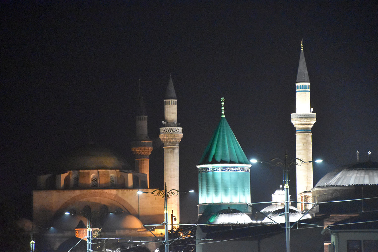
September 4-6, 2015: The Mystic Dances of the Dervishes (Mevlevi)
Konya, situated at 1200 m altitude and with around 1 mio inhabitants, is one of the most important centres of Turkey due to several reasons: Firstly, in its history, it was the capital of the Seljuk Empire and, secondly, it is the place of origin of the Dancing Dervishes. Today, Konya is the capital of the largest province of Turkey that covers and area a bit larger than Switzerland (!). The city is surround by fertile and well irrigated agricultural land, predominantly cultivated by wheat, however also by fruits, vegetables and sugar beets, as well as flax and poppy (state controlled cultivation for medical purposes only …). Konya today is an industrial city (agricultural processing), crafts and trade (located in a beautiful Bazar), carpet and kilim weaving and tourism.
Aziziye Madrassa in rococo style (Persian influence, built 1676 and renovated 1867-74)Aziziye Madrassa in the evening light
Konya is also known as a religious and conservative place. Well known beyond Turkey is the imposition of the female students at the local university to wear the head scarf during the lectures, what has been forbidden since Atatürk’s time. Today, under the conservative and religious dominant political party APK, this practice is accepted more or less throughout the country.
The pilgrims, who visit the grave of Mevlâna, the founder of the congregation of Dervishes, give the city a special appearance. More traditional women and men dresses are seen than in other places of Central Anatolia.
In the bazar of KonyaBazar with the minaret of the Aziziye Madrassa
Also shops close earlier and it is very difficult to get a beer, a glass of wine or a Raki.
The history of the city dates back to 3rd millennium BC. Later on, Hittites, Phrygians, Assyrians and others followed, including the Romans.
In the Archeological Museum one can find superb artefacts from the neolithic to bycantine periods; neolithic objects are from Catal Hüyül, a place close to Konya and largest neolithic excavation site worldwideNeolithic bathtube from the excavations at Catal Hüyük
Christianity has come to the city around 50 AD through Paulus and Barnabas. Iconium, the former Konya, has become the seat of the Bishop in 3rd century. With the dwindling power of the Byzantine Empire the Seljuk took over and established and made it to the capital of the Sultanate of Rum. Emperor Friederich I. on his third crusade in in the year 1190, besieged the city but could
Herakles sarcophagus (3rd century AD) in the Archeological Museum of Kony
not occupy the citadel. In an accord between Friederich and the Sultan it was agreeded that the Seljuk provide supply to the crusaders in their further moving to the East.
Thereafter Konya has been developed to a magnificent capital. Under the Seljuk Sultan, Alâeddin Keykûbat, at the beginning of the 13th century constructed the most important building, including the Alâddin Mosque (inspired by the mosques in Damascus, Cairo and Cordoba), the Sultan Palace, and the City Wall with108 defence towers (the latter, however, is not existing anymore).
During our visit to Konya, however, the Alâddine Mosque
Alâddine Mosque under renovation
was under renovation and thus we could only enter the central prayer hall, with a beautiful Qibla (wall of the mosque directed to Mekka).
Qibla in the Alâddine Mosque
The highlight of our visit has been the evening performance of the Dervish Dances in the Cultural Mevlâna Centre.
The Mevlâna Monastery is located right in the centre of the city and is the most important building of Konya.
The Mevlâna Monastery with the green Türbe (grave)
It hosts the grave of Celâleddin Rûmi, the great mystic, poet and philosopher, who formulated the basic ideas of the congregation. His grave or the monastery is also called the ‘Kaaba of the Turks’ and can replace the pilgrimage to Mekka.
Inside the Mevlâna Monastery
The founding of the Mevlâna order is closely linked to the political and demographic changes of the 12th/13th century when Christian-oriented Anatolia has been taken over by Turkish people which created far reaching political, cultural and religious changes. During this period of important reorientation, different orders have been founded (e.g. Bektasi, Ahi and Mevlevi), many of them originating in Sufism, a mystic movement that goes back to the early period of Islam (the term ‘sufi’ indicates the woollen dress of itinerant monks, propagating propertylessness and contempt of the world, similar to the Christian mendicant monastic orders). The followers of the order included people from all social levels and trade, including military, to ensure influence on the economic, social and political development of those periods.
A Mevlâna in the typical DressDancing Dervishes
The Dancing Dervishes was mainly rooted among the upper society and in arts and was initiated by Celâleddin Rûmi in Konya. Their followers were named Melâna (our master). They were dressed in a white skirt without sleeves, a coat with wide sleeves, a belt and a black wrab. On the head they wear a high felt cap.
Spiritual experience in mystic dance
The Dances of the Dervishes has their mysical background among other in the relationship of its founder Rûmi with Semseddin of Tabriz, an itinerant preacher. Rûmi has becoming mystically and spiritually dependent of Semseddin. This relationship created concerns among the followers of Rûmi, which resulted finally in the disappearance of Semseddin. Rûmi, who suffered tremendously under this loss, developed (similar to other mystics) the idea of identification with the mystically loved being and thus realized the central role of music and dance; dance and praying directed him on the path to the unification with God. Rûmi experienced the unifying power of tolerance. In his experience of spiritual love, he unified the separating elements and was against the buildings of sects. Difference between religions did not exist for him anymore. With his spiritual experiences and ideas, Rûmi has become the most important mystic, philosopher and poet of the Islamic world of his time.
September 4 and 5, 2015: From Avanos to Eregli and Konya
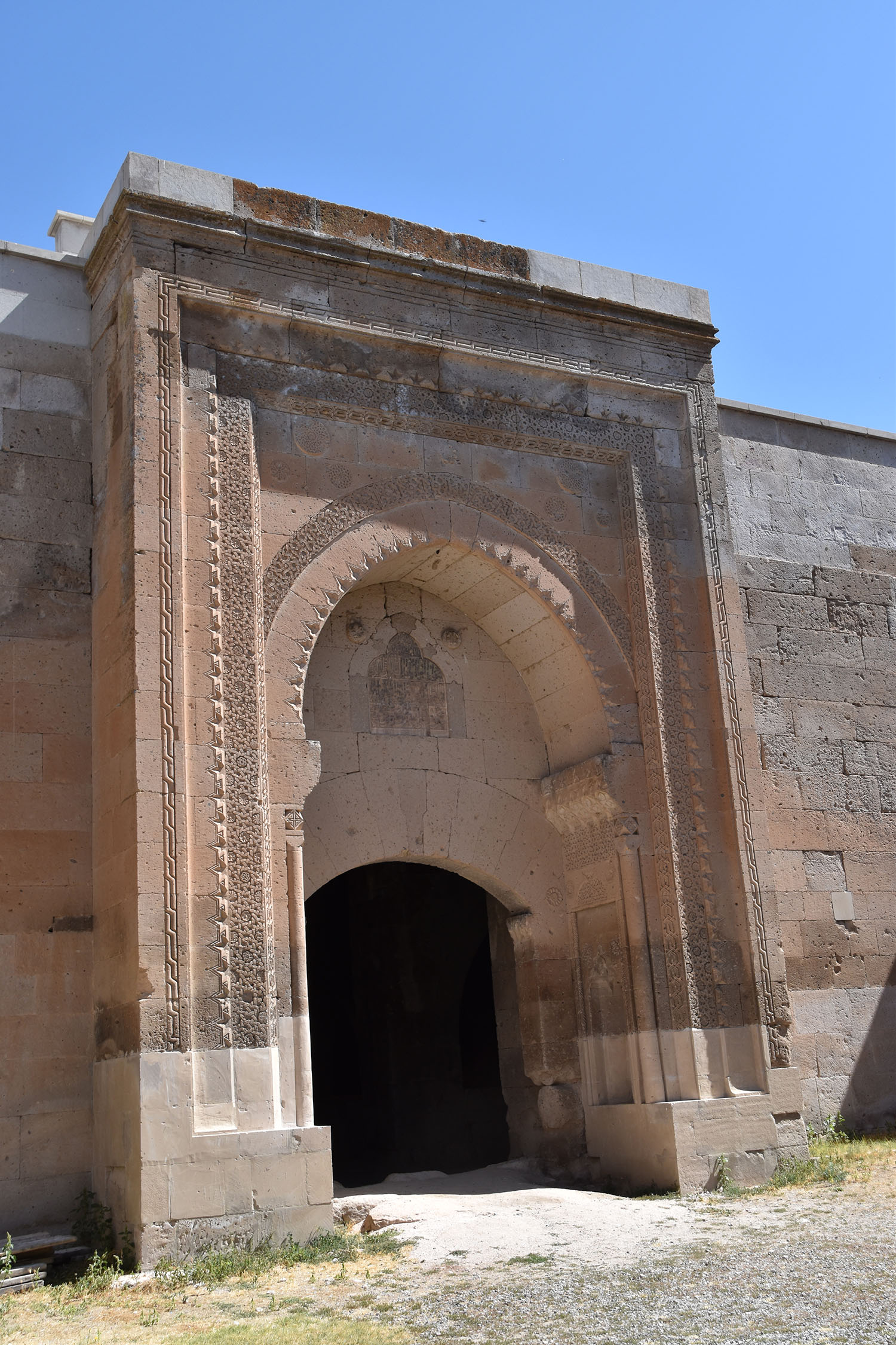
First we thought that this part of the trip is just a transfer of several hundred kilometres and little to see. However, we underestimated Turkey with its many wonders. On the way we visited two Seljuk Caravansaries built in the 13th century; the first one on the way to Aksaray – Sultan Hani – and the second in Karapinar, a smaller rural town.
Caravansary Sultan Hani with ist entrance PortalCaravansary in Karapinar with its covered winter hallsCaravansery Sultan Hani – Stone work at the entrance portal
Both structures are very impressive, considering that these huge structures were built as overnight quarters for traders travelling South-North from the Mediterranean to the Black Sea and from East-West connecting Persia and beyond with Europe. The fully covered and large halls with its tall arches looked rather like a big church than an ancient ‘hotel’. The entrances portal consisted of rich carved stone work as it would be a 5-star lodge.
Aksaray: Ulu Cami built in the 15th century by the KaramanidesDöner Kebab stall in AksarayAksaray: Zinciriye Madrassa, built by the Kamamanides in the 14th centruy
On the way we stopped in Aksaray, a town with a great historic history, however limited buildings have survived. The most important are the mosque Ulu Cami and the Zinciriye Madrassa, build in the 15th and 14th century, respectively. In both structures the entrance portals with their stone carvings are impressive. The Madrassa has recently been very carefully renovated and re-stuffed by the municipality. The halls are used for teaching and as a library.
From Sultan Hani to Karapinar: large plains intensively cultivated thanks to irrigationA whirlwind in the plain between Sultan Hani and KarapinarClay houses along our route to Eregli
From Sultan Hani to Karapinar we followed 3rd class road (a white road on the map). Once again we were astonished about the good quality of such minor/rural roads. For the night we stayed in Eregli, a rural town. In spite of its remoteness, the centre with its bazar, i.e. the shops and restaurants, was full of live till late in the evening. For us this was an indicator that business is active. New buildings, workshops and small factories (agricultural processing) at the outskirt of the town confirmed this observation.
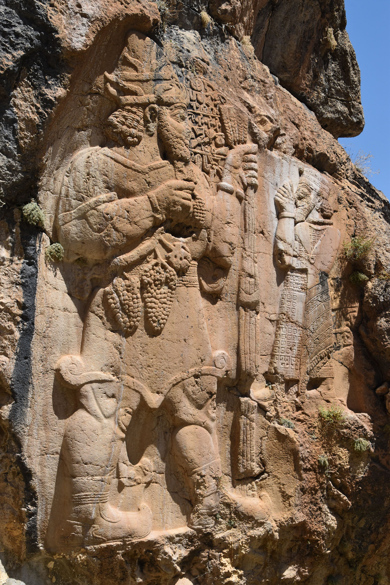
Hittite rock relief of Fertility God Tarhu and King Warpalawas of Tyana (around 730 BC)
The day after we visited a three meter high Hittite rock relief few kilometres outside in the mountains behind Eregli. This relief has been made around 730 BC and presents King Warpalawas of Tyana and the Hittite God of Fertility, Tarhu, opposing one another. The monument is situated at a very water-rich river source that just flows out of the rocks. God Tarhu is shown with grapes and the King in a praying Position.
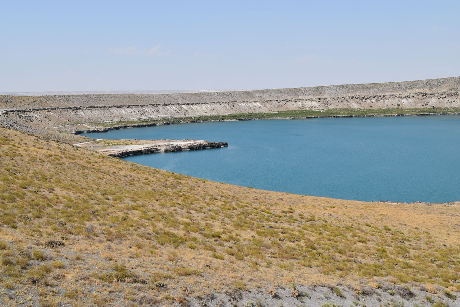
Aci Göl, a oval crater lakeAci Göl: Village youth with blasic bottles as swimming aidsMeke Gölü, the crater lake with the Meke Dagi, the vulcano cone in the middleFlowers at the slopes of Meke DagiFlowers at Meke DagiFlowers at Meke DagiThe summit of Meke Dagi with view into the crater
On the way to Konya we stopped at the Aci Göl (bitter lake), an oval volcanic lake. We did not taste the water, but some village boys were swimming using empty plastic bottles as lifting aids.
The next stop was at Meke Gölü a circular (explosion) crater lake surrounding the Meke Dagi, a volcanic cone. The lake is heavily salty with a high content of sulphur dioxide. Gabi
and I decided to climb the cone with its slopes of nearly 40° and a height of around 100m. The way up on loose slag was two step forward … and one step sliding back. It was hot and the sulphur dioxide stinking terribly. The vegetation at the slopes consisted of small bushes and flowers. The mountains seems also to hosts many different bird species, some of them nesting in small caves. After some 45 minutes we reached to top (1250m) and enjoyed the beautiful view. The downhill travel was much easier and faster. We just slid down and reached the crater lake in around 10 minutes. My shoes however were gone as the sole has disintegrated from the upper leather.
In the evening we reached Konya, an old cultural and religious city, once upon a time the Center of the Seljuk empire and home of the congregation of the Dancing Derwishes. We found our lodge right in the middle of the old down, next to the bazar.
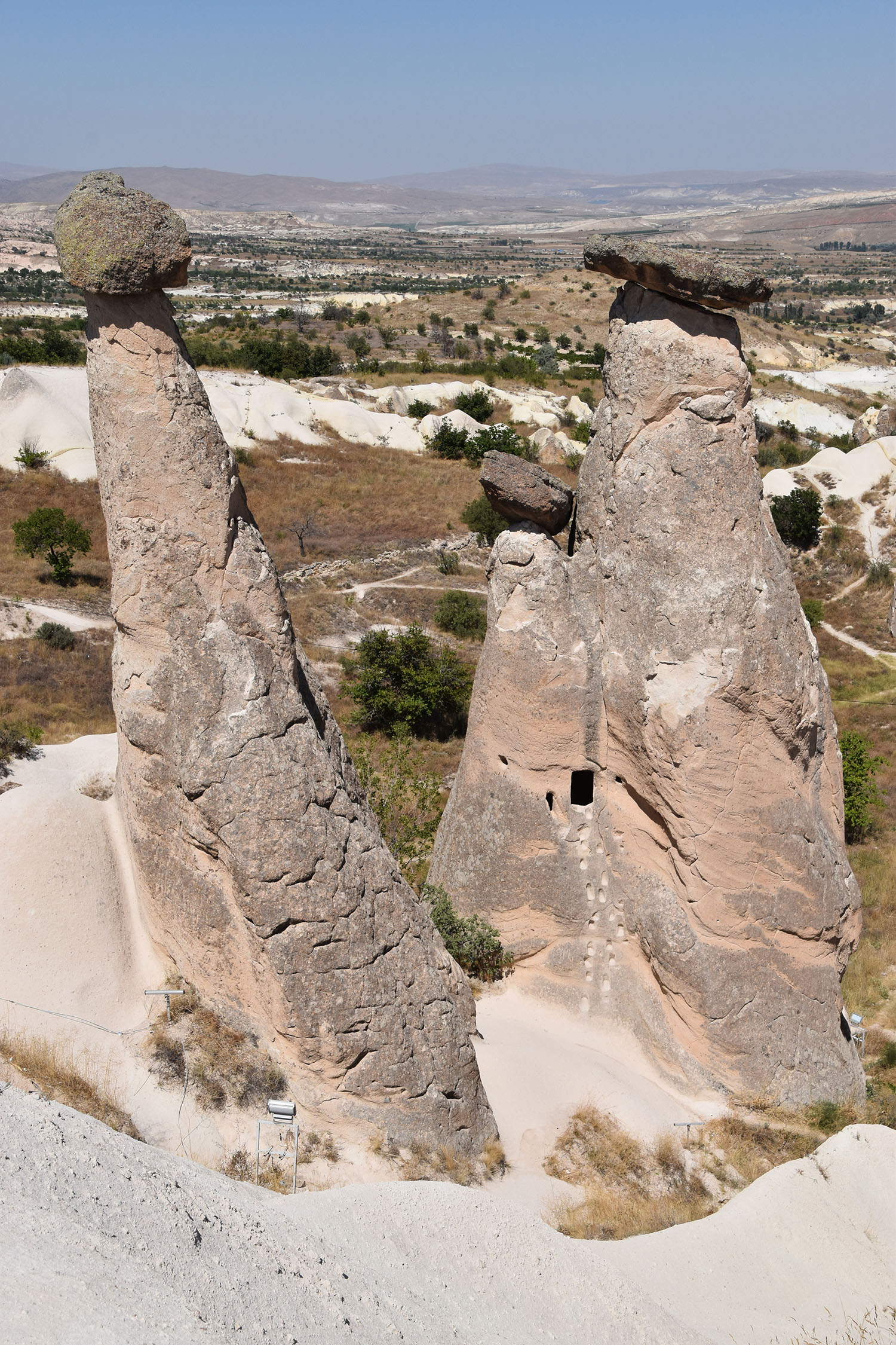
August 30 – September 3, 2015: Cappadocia – voir et mourir …
Kappadokien
„Cappadocia“ sehen und dann ……ben. Nein, noch nicht.
Erosion of the tuff layers created fairy tale landscapes. Many of these ‚towers‘ are hollowed and converted into living space.
Dies war mein (Gabi`s) wichtigstes Ziel in der Türkei. Irgendwann einmal in Georgien habe ich Bilder der Märchenlandschaft gesehen und seither hat mich der Wunsch, in diesem Gebiet herumzuwandern, nicht mehr losgelassen. So sind wir mit Tips von Günther und Maren über Kayseri in Avanos eingtroffen und haben in der Töpferstadt eine kleine Pension (Bir Kedi – eine Katze) gefunden für 4 Nächte. Von Avanos aus haben wir die verschiedenen, touristisch erschlossenen und weniger erschlossenen Orte besucht, die alle im Umkreis von 80 km Entfernung liegen.
Like ‚glacier tables‘ the hard rock Piece on the top protects to lower soft rock and creates this unique pyramid.Rock dwellings over several Levels. Earthquakes exposed the inner parts of these ancient villages
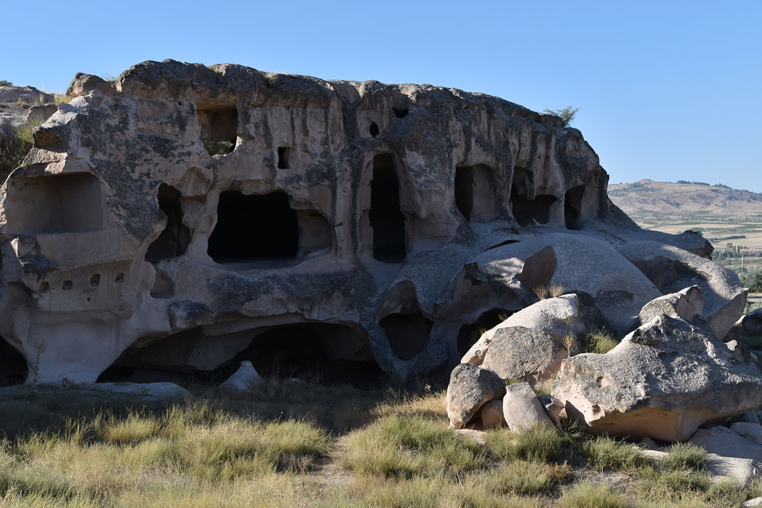
Kappadokien bietet Unterschiedliches: Es ist ein Gebiet mit Höhlenstädten und Märchentürmem, mit versteckten grünen Canyons, voll von Felsenkirchen und Überresten von Behausungen der Bewohner von verschiedenen Zeitepochen zwischen 8000 vor Christus bis heute (an gewissen Orten).
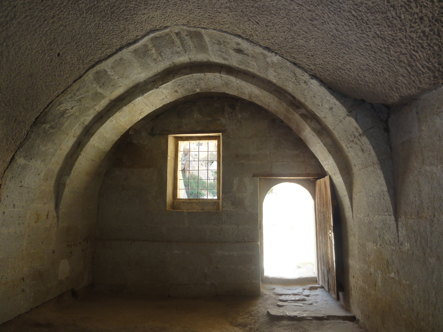
Das Gebiet liegt in einer Zone die durch vulkanische Aktivitäten ihr Gesicht bekommen hat. Canyons und Flächen mit Tuffsteinkaminen wechseln sich ab. Der Tuff besteht aus verschiedenen härteren und weicheren, roten,schwarzen und grünen Bestandteilen, die der Erosion über die Jahrtausende unterschiedlich standhielten und so eine märchenhafte Landschaft entstehen liessen. Diese wurde durch Menschenhand kunstvoll ausgehölt und zum Teil unterhöhlt. Diese Behausungen boten Schutz vor Angreifern, waren klimatisch perfekt eingerichtet als Lager- und Wohnraum, wurden über die Jahrtausende abwechselnd oder auch gleichzeitig von Bauern und Mönchen benutzt und ausgebaut.
Scetch plan of a Cappadiocia rock dwelling with living and economic rooms. Some of these farm houses looked rather like small palaces with large stables and chapels and artistically decorated wallsAncient farm house near Gülsehir
Kleinere und grössere Erdbeben haben im Laufe der Zeit ganze Komlexe zum Einstürzen gebracht und die Erosion durch Regenfälle geht jährlich weiter.
Kappadokien erlebt einen Ganzjahrestourismus. Dementsprechend sind Die Eingänge zu den scönsten Tälern und der grössten Untergrundstadt sehr touristisch ausgestattet. So sind Keramik-und Teppichläden vertreten und es werden viele kleinere Souveniers verkauft. Sehr attraktiv
Je nach politischer Lage des Landes wechselt die Herkunft der Touristen; der Zustrom ist aber in diesem Gebiet nicht versiegt.
Cappadocia was Gabi’s destination and visit dream on our travel back home. And, indeed, this region of Central Anatolia bears historic, cultural, religious and geological/morphological treasures – or, as UNESCO declares, it is a unique site of Word Heritage.
Let me briefly give some background information on the geology and geography that has formed the landscape in this region and about Christianity that has been spread to Cappadocia in the 2nd century AD and was the dominant religion till to the 14th century.
Cappadocia – a fairy tale landscape, intensively inhabited over thousands of years.Mushroom rock
The central part of Turkey has been formed by intensive volcanic activities along the tectonic fracture zones of the Taurus faults and creating a series the volcanos (among close to Kayseri – Erciyes Dagi of 3916 m – and several others the near vicinity). During the geological period of the Pleistocene, the volcanic eruptions throw out ashes, slags, rock debris and lava streams covering more than 10’000 km2 crating an immense cover of tuff layers. The fluviatile erosion thereafter created a dense network of valleys, deep canyons and gorges with bizarre stone formation such as the fairy chimney, mushroom stones, table plateaus and others. The volcanic tuff layers appear in all different colours, sometimes white, black, green, brown, red and grey, according to the chemical composition.
The spreading of Christianity at the beginning through monasticism started in the 2nd century in a region of a complex pattern of different religions, such as the Hellenistic and Roman, the Mithras-cults from Persia, Judaism and different other mystic beliefs. The young Christianity in Cappadocia has been intensively influenced by the doctrines of dualistic religions of Gnosticism (that in fact strongly impacted all religions of the Mediterranean). In the 4th Century, Christianity has been become state religion in Central Anatolia.
The fight over religion doctrines in the church has also intensively been carried out in Cappadocia (between the Monophysites, who understand Christ as divine character only, and Orthodox, who see in Christ a divine and a human nature; the formal split into a roman-catholic and an orthodox church happened much later in 1054 AD at the Council of Constantinople).
The church and monastic parishes, subordinated to the Patriarch of Constantinople, could continue its religious life also under the Seljuk and Ottoman rule, however under the latter a further development and spreading was not possible anymore.
Byzantine church fresco from the 9th to the 13th centuryByzantine fresco in a cave churchByzantine fresco
Still today, witnesses of the flourishing Christianity are the many monasteries and churches with its unique colourful frescos.
During our visit to Cappadocia we realised that three to four days by far are not enough to visit all the important and interesting site. Nevertheless, we got a good impression of the most important features of this habitat.
The most interesting part of the region is the type of cave dwellings developed by the people and brought to perfection. The people of Cappadocia made use of the unique geological formation, the volcanic tuff that allowed to carve rooms into the
Wall decorationPerfectly formed rooms deep in the rock
soft but sufficiently solid rock layers. Thus they used the eroded rock pyramids for this purposes and established entire homestead and farmhouses with living and economic units (stable and barns) as well as – the richer ones – with integrated chapels. The cave houses provided perfectly air-conditioned climate. During our stay, the outside temperature climbed up nearly to 40°C while in the caves it never was higher than 25°C.
In different parts of Cappadocia, the people of those days built monasteries in rock walls/canyons with several dozen of rooms, churches, economic units, stables, community kitchen over several levels. These rooms were interconnected with tunnels in the rock.
In the town of Derinkuyu, in 1963 an underground city at 12 levels for 10’000 people has been discovered. Today, part of this dwelling has been made accessible to the public. Several underground cities exists in other localities but Derinkuyu is the most impressive one.
Underground City Derinkuyu: multiple Levels connected through narrow tunnelsMill Stone like rolling door to Close the tunnel if the enemy enters the Underground CitySchematic design of an underground city with with ist multiple vertical layers
Tectonic activisms caused earthquake that brought canyon walls and cave structures to fall. Thus many of cave dwelling were abandoned and left to erosion. However, people were living in some of the rock dwellings till 1950’s when they had to be evacuated due danger of collapse. While travelling through this unique landscapes, one finds left and right along the roads hundred thousand of cave dwelling, some better, other less preserved. The rocks look like a Swiss cheese consisting to a great part of holes. I strongly belief that not yet the final chapter of Cappadocia has been written and new cave dwellings might be found.
Cappadonian rocks like Swiss cheese
Gabi and I have been visiting cave dwellings in Crimea, Georgia, Iran and in Armenia. What we have seen in Cappadocia, however, is sensational regarding diversity of different types of carved out houses and the artistic elements (frescos, sculptures and stone ornaments.). The Turkish government has made good efforts in the conservation of this world heritage and making these sites accessible to the public. At the same time they have developed a tourism industries that is economically most beneficial to the region. Most of the visitors we met have been Turkish,
Turkish tourists visiting the wonders in Cappadocia
followed by Asians (Korean and Chinese) and West European (mainly French and Italian).
For our excursions in Cappadocia, we have chosen in the pottery town Avanos a small B&B Guesthouse (Bir Kedi) situated on a hill top above the old centre offering traditionally decorated bedrooms with walls of tuff stones and a roof terrace overviewing the town and the entire Cappadocia plain with all the historic and geological wonders.
Wednesday to Friday, August 26-28, 2015: Still in the ethnic region of Kurdistan, from Zara to Divriği and Malatya to the Nemrut Daği
August 28, 2015 – Nemrut Daği and other historic sites
Nemrut Dagi fascinated me since I saw its pictures with the colossal sculptures on the barren hill/mountain (in the middle of (the) nowhere) some 50 years ago! And here I am, freshly retired, to visit and admire this historic and cultural landmark.
The appropriate manner to approach this spiritual site
Nemrut Dagi, the 50m high rubble hill of fisted-sized Stones on 2150m altitudeNemrut Dagi, East terrace with (from left to right) Antiochos, Kommagene, Zeus, Apollon, and HerkelesHerkeles, Antiochos, Kommagene, Zeus and the protecting eagle
would have been to walk all the way up, for hours, suffering under the heat and the rocky and steep path, the manner, the people and followers of the King Antiochos, ‘… God, the righteous, Epiphanes, friend of the Roman and Hellen, son of the King Mithradates Kallinikos and the Queen Laodike …’ have done it. Nevertheless, we followed with our car the newly prepared and well maintained mountain road up to the parking space some 150 meters below the top. From far, we could see the unique hill peak fully covered with fist-sized stones by Antiochos labours at 2150 m altitude. Originally the rubble hill has been 75 m high but due to earlier search for the grave of Antiochos, the tumulus has been lowered to 50 meter (and nothing has been found till today – Antiochos tomb seems to have vanished for good).
Nemrut Dagi, West terrace: Lion and eagle as protecting animalsNemrut Dagi: Kommagene
At the foot of the tumulus, sculptures have been erected at the Eastern and Western terraces, Antiochos sitting on his throne next to the Hellenistic pantheon, with Zeus and Heracles and others. Many of the huge stone sculptures are very well preserved. Antiochos grave site has been built on his empire’s highest point and indeed, the view to all directions is spectacular, to South-East to the upper plains of the Euphrat, to the North-West to the East Anatolian mountains. Far down in the haze of the heat of the lower area one sees all the green irrigated areas. Magnificent! Gabi and I were sitting for hours enjoying the view, relishing the artistic beauty of the site, diving into ancient time, imaging the religious rituals of thousands of people who climbed up to perform their religious rituals. And among them Antiochos, the King of the Kings (who thought to be God and got killed by the Romans). The unique thing is that Antiochos linked up the Hellenistic/Roman religion and cultures with the Persian one. One finds these different elements in the statues of Nemrut Dagi.
After the unforgettable visit we went to see Eski Kahta/Arsameia at Nymphaios with some beautiful reliefs (King Mithradates shaking hands with Herakles!) and the Fortress of Yeni Kale on an ‘impossilbe’ rock top and the Roman bridge Cendere Suyu of 120 m length and 7 m width, displaying the high architectural and engineering skill of the Legion XVI Flavia Firma.
Arsameia: Mithradates shaking hands with HerkelesArsamaia: Recent and ancient godessesRoman Bridge built 198/200 A.D.
On dirt roads across the mountains through remote but beautiful Kurdish villages we reached our village Karadut. On the way (actually on Nemrut Dagi), we found a bottle of white wine we chilled in the toilet tank of our room and sipped it later on with our Asian friends in the evening.
In Karadut haben wir eine kleine Oase gefunden: Einen Garten unter Nussbäumen mit bequemen Plastikstühlen(wo ich auch diese Zeilen schreibe), Murat einen aufgestellten Pensionsbesitzer mit seiner achtköpfigen Familie, ein grosses Zimmer mit Internetanschluss, ein interessantes junges asiatisch/amerikanisches, reisendes Paar, ein erfrischendes Lüftchen und blauen Himmel. Was wollen wir noch mehr nach dem Trubel in Malatya und anderen Städten in der Region. Dieses Dorf Karadut liegt an der Zufahrt zum historisch sehr interessanten „Nemrut Dagi“, des heiligen Berges und sollte von Touristen als Ausgangspunkt für den Ausflug an die hier vorhandenen historischen Stätten bevölkert sein. Die politischen Probleme und Medienberichte halten jedoch einheimische Reisende und Fremde im Moment davon ab, dieses Gebiet zu besuchen. Auf der Strasse neben dem Restaurantgarten traben die Bauern mit den typischen Pludderhosen und dem gehäckelten Käppi auf dem Kopf auf dem Rücken der Esel vorbei und gehen auf Holzsuche. Die Dorfleute erwidern den Gruss, sind sonst aber sehr zurückhaltend uns gegenüber. Auf dem Berg (Ruedi berichtet darüber) waren wir gestern lange Zeit die einzigen Besucher. Auf unserer Tour zu den weiteren historischen Plätzern (Burg in Renovation, Höhlen und Skulpturen, Brücke) wurden wir immer wieder zum Tee eingeladen von Ladenbesitzern, für die wir die einzigen Besucher waren. Diese Situation und die vorhandene Zeit ermöglicht lustige Begegnungen für uns und die Teehausbesitzer, die ein bisschen bis gut englisch gelernt haben von den Reisenden.
August 27, 2015 – From Malatya to Karadut
This Thursday was a day of travel, travel through gorgeous landscapes in the Western part of East Anatolia (or politically incorrect Kurdistan). We followed the less beaten tracks (in the map the ‘white roads’), and first we went down to the huge Atatürk reservoir stretching over 100’s of kilometres and extending to the many Valleys.
Atatürk Reservoir of the Euphrat riverLandscape close to AdiyamanTabaco fields
Good 25 years ago when I was working as a consultant on an Anatolian rural development project (on behalf of SDC), I have been visiting the huge dam under construction with the aim to generate electricity and use the water for irrigation. The whole water catchment project was under international dispute as it included massive dislocation of entire villages and thousands of people. In addition, Syria and Irak protested against this project as they feared to loose their key water resource.
Drying of tabacco leaves
Thus the World Bank was not willing to provide loans and the Soviets, who also were approached, were unable to provide financial resources. As far as I know, Turkey finally went ahead with their own resources as they considered the economic development of East Anatolia a priority issue and part of its strategy to fight separatism. The critics, however, mentioned that not the local (Kurdish) population is primarily to be benefited but resettled Turkish farmers. I don’t know what finally has happened as I did not follow-up the results of this huge undertaking. Today, and this is remarkable, an incredible development that has taken place in East Anatolia. This is visible at any step of our travel. The extended East Anatolian plateau are intensively cultivated. One sees big tractors all over (of the brand: New Holland) and other machinery even in remote villages. Fully mechanised agriculture is omnipresent (however, I fear without environmentally friendly agricultural cultivation techniques …).
On our day trip off the beaten tracks we followed narrow agriculturally cultivated valleys with extensive Tabacco (monoculture) cultivations. They were well taken care of and the lush green contrasted beautifully against the barren and brownish mountain slopes. We drove to Adiyaman (where we had a short walk in the centre and eating an colourful ice cream with a consistence of chewing gum), we continued to Kahta with the intention to stay overnight. However, being not too far from Nemrut Dagi, the destination of our desire, we spotted on ‘booking.com’ a Pension/Camping with the satisfaction rate of 9.1 (out of 10) in a village – Karadut (Isik Pansiyon, www.nemrutisikpansion.com) – close to our cultural destination Nemrut Dagi. Another 42 km brought us there, up in the mountains, a cool place in both senses, with a magnificent sitting area in a garden under walnut trees and a simple but clean room. Murat, the owner and boss of the eight headed family, welcomed us and handed over the key. We spent the evening in nice company with a Turkish and an Asian couple.
Walnut garden in KaradutOne DP vehicle of the village youth in Karadut
August 26, 2015 – from Zara to Malatya
We still haven’t given up on visiting Nemrut Daği as one of the most fascinating, historic and bizarre site of antique history and thus, in order get around the PKK, we drove from Zara towards south to Divrigi, a town at the upper Euphrat and lying along the old trade route from Syria via Malatya to North Anatolia.
Mosque and Hospital in Divrigi (built in the 13th century)One of the three portales of the mosque in DivrigiView from the castle in Divrigi down to the valley
Divrigi has a multifaceted history with an Armenian/Paulicians (religious warriors), Byzantine and Islamic background, which is still traceable while walking through the today, rather rural, conservative and sleeping but charming town.
Today, of particular attention is the complex of the Ulu Cami (mosque) with its quinquepartite aisles and the Hospital, both units constructed to one another. They have been built at the beginning of the 13th century. Both of buildings have been very carefully and well restaurated. Apart of the huge and massive prayer halls we admired the artistic and unusual entrance adornments we haven’t seen anywhere before.
Magnificant landscape …Ulu Cami in MalatyaRoyal hotel room for USD 40
To the north on a large to the West inclined rock plateau (falling to the East vertically several hundred meters down to narrow valley), one finds an old fortified however more or less destroyed castle. It also includes the foundation of the ancient Armenian Church. Presently the big defence walls are partially rebuilt as part of the restauration activities. We enjoyed the hike up. We were the only one as presently very few tourists are travelling due to the ongoing civil conflict that keep people to stay at home or to visit more secure places. Gabi and I were sitting for quite some time on the hill top, admiring the beautiful view and the fresh wind before we went down to the village and to continue our journey to Malatya, our final destination of the day.
Malatya, in contrary to the remote and rural area, is a vibrant city. We found our hotel (City Kent) right in the centre next to the bazar area in the pedestrian zone (difficult to approach by car …). The room was spacious with a royal red sofa and armchair in plastic and golden ornaments. The late evening stroll through the heart of the city did not result in finding a cold beer or a bottle of wine but a Turkish coffee (that stole my deep sleep in the night, later on).
We planned to cross the Eastern Anatolian plateau and mountains from North to South in its Eastern part, namely from Erzincan to Elazig to proceed thereafter to the Hittite historic sites at Nemrut Dagi. Informed military sources confirmed that that this road, more than hundred kilometres West of Bingöl, is outside of the recently emerged Kurdish-Turkish military conflict. We drove up and down the beautiful mountain road looping along the narrow valley of steep and partially forested slopes, following a wild river and sometimes overcoming rock barriers through tunnels. We stopped regularly to take photos of this spectacular landscape that reminded me of the description of Karl May’s book ‘Through the wild Kurdistan’ I/Ruedi read enthusiastically as 12 years old boy. The region seemed quiet, some Turkish army or policy barracks/posts along the road did not signal any special emergency; there was hardly any traffic on the road. Suddenly, however, we passed three freshly burned out trucks lying left and right at the road side – we got an uneasy feeling. Few hundred meters after, there was a bus parked and people standing around. The road was signalled with tyres to drive slowly and following the marked path. Two persons with Kalashnikovs stopped our car – friendly and calm and welcomed us to Kurdistan. The two fighters were two ladies in brown Kurdish trousers and shirts, long black hairs, the skin sun burned, the face firm and determined. They politely made us understood to inform from where we are coming from and where we would like to go. We explained and they permitted us to proceed. One of the fighters introduced herself as named ‘India’ and hailing from Mardin. Anyway, we decided to return and not to take the challenge to run into any further road block and encounter. We feared to get in between the front lines of the PKK and the Turkish army. We turned the car – and the ladies didn’t mind- and drove back to Erzincan and further to Zara, a town situated around 80 kilometres before Sivas.
The landscape of the Western part of East Anatolia remained beautiful with its rolling hills between 2000 and 3000 meter altitude, intensively cultivated with orchards where irrigation water is available and cereals in rain fed areas. The vast hills are used as extensive pasture land for cattle, sheep and goats.